Category Archives: Costa Mesa

Bike path on campus

Orange Coast College Welcomes Students Back with Active Transportation Improvements

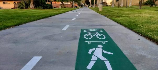
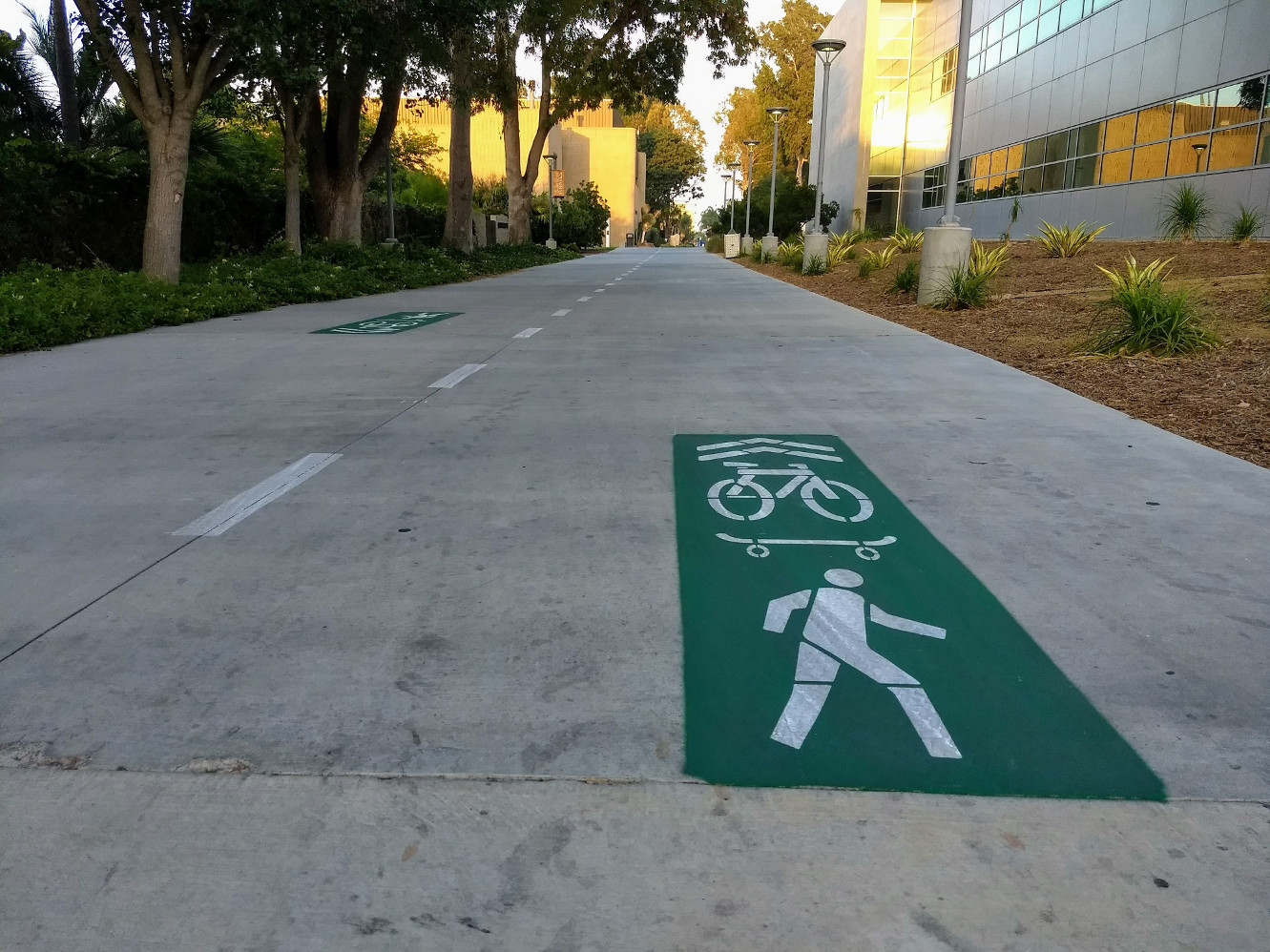
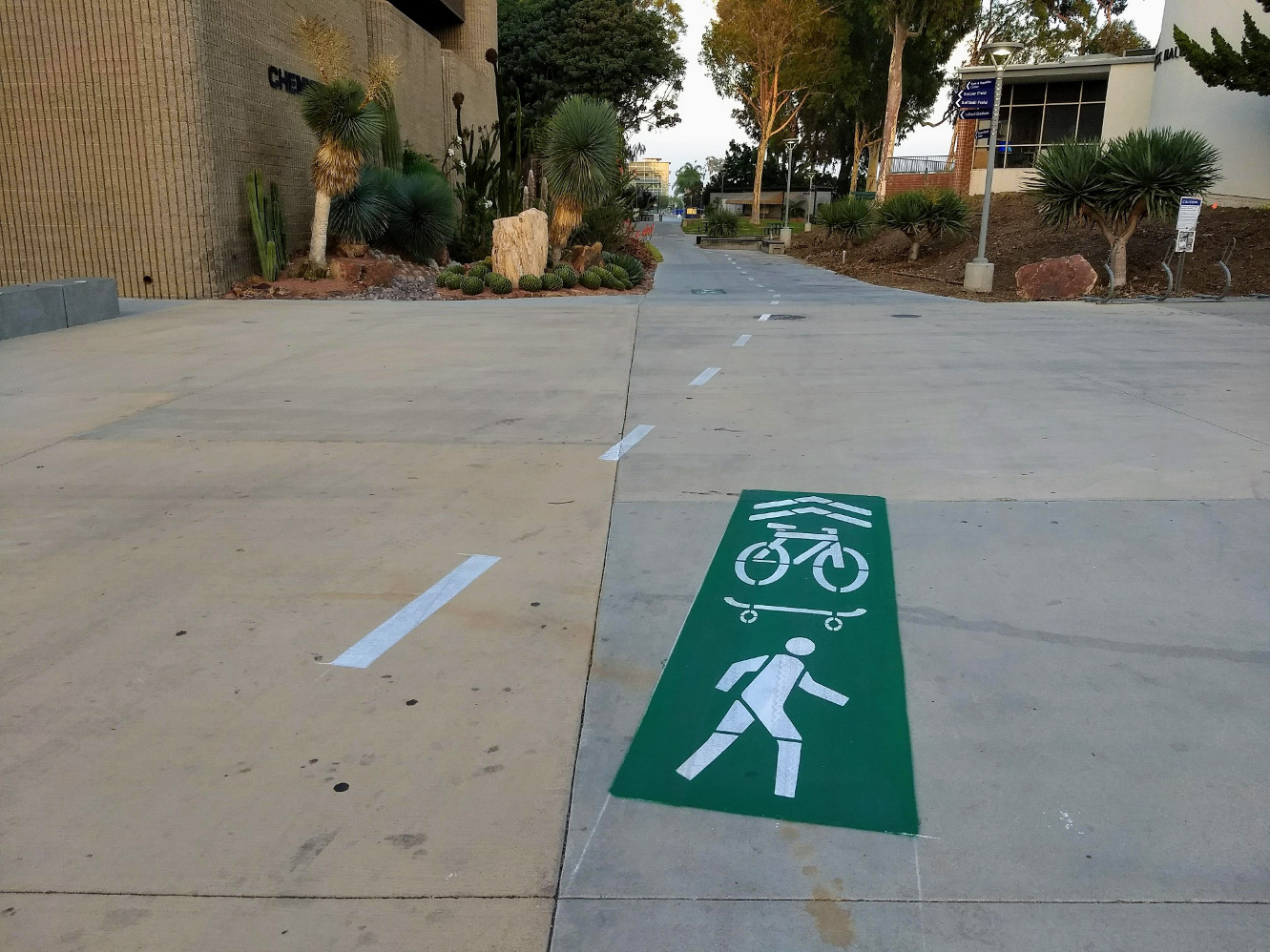
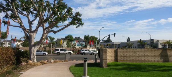
Students returning from summer break at Orange Coast College discovered that the campus was adorned with some new paint:

Bike lanes painted on a campus
Orange Coast College’s Wheeled Transportation Loop, seen freshly painted near Allied Health and Technology.

The college first demonstrated this wheeled transportation loop in conjunction with Green Coast Day and Explore Merrimac back in April.  At that time it was marked with spray chalk and temporary signage; due to the success of that demonstration, it’s now marked with paint!

Map of the OCC transportation loop
Map used on Orange Coast College’s “Ride the loop” sign during their April 2018 Wheeled Transportation Loop demonstration.  Due to the construction of the new student center, the lower portion of the loop (that travels through the campus quad) is not able to be painted at this time.

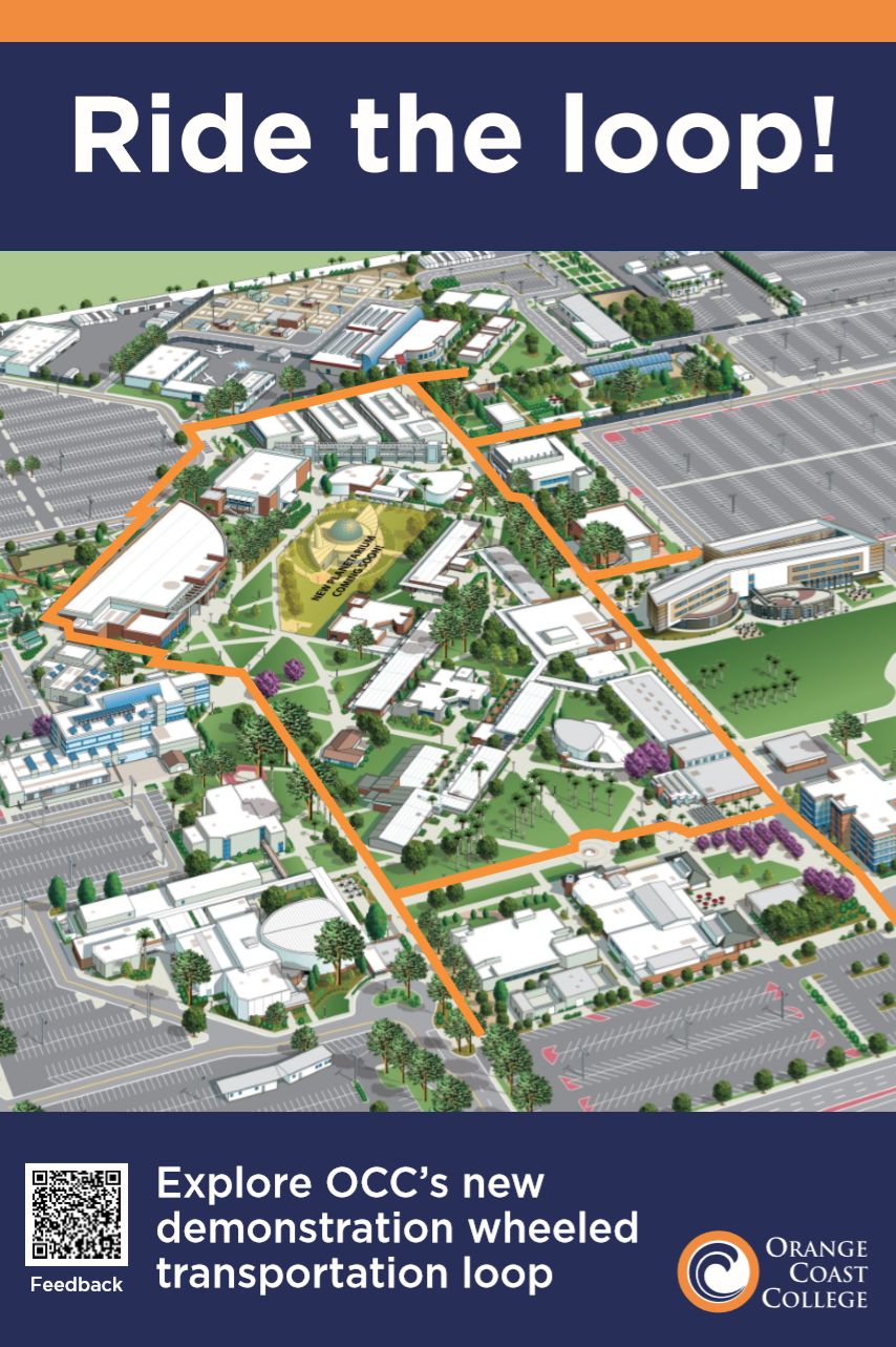
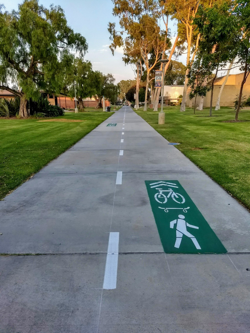
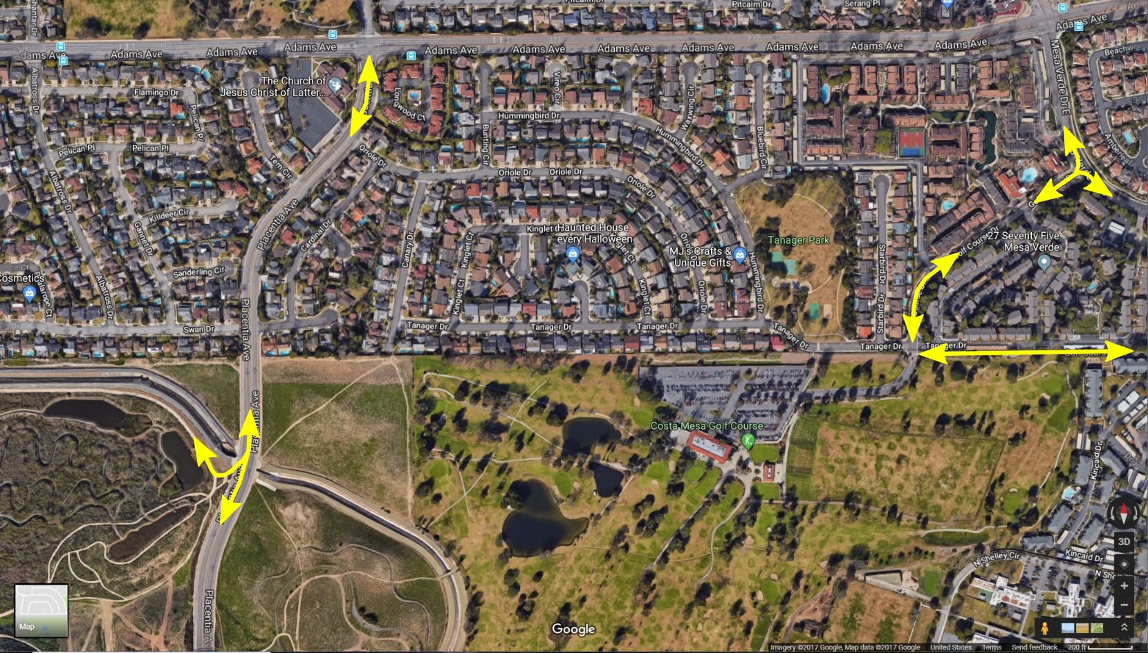
The goal of the loop is to direct people on bicycles and skateboards to wider, safer pathways via clear markings.  Traveling on this loop will allow users of wheeled transportation to traverse the campus in virtually no time, and also to roll to within 100 yards of all campus buildings.  The markings also help alert walkers and other path users to the possible presence of bicyclists and skateboarders (so, to be clear, these are not bike lanes; they’re shared use pathways).

Bike path on campus
Near Biological Sciences and Horticulture.  The imagery of a bike, skateboard, and walker all in the same square is intended to show that this is a shared use pathway, with striping and arrows indicating directionality.

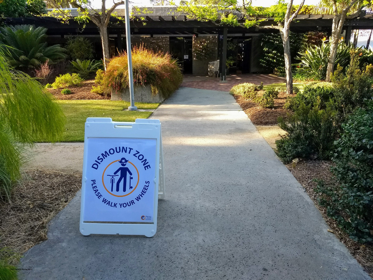
As part of this project, the campus will also be creating dismount zones, where users are asked to walk their wheels.  The largest of these is in the core of the campus (the region inside the loop), where pathways may be narrow, have pinch points, pass classroom doors, and/or have blind intersections that would be dangerous to ride through.

Redirecting people on bicycles and skateboards from narrow, unsafe pathways to the wide, well-marked loop should result in a much safer transportation experience for everyone at Orange Coast College.

Sign with cute pirate and "please walk your wheels"
A dismount zone sign in the Horticulture Gardens seen during the April 2018 Wheeled Transportation Loop demonstration.

While this is a tremendous win for those of us who ride our bikes or skateboards (or kick scooters!) to/on campus, we need to be sure that we use this new loop wisely.  Just as paint can be applied, it can be removed or painted over, so please: ride responsibly on campus.

Bike Path on campus
Near Chemistry and Science Hall

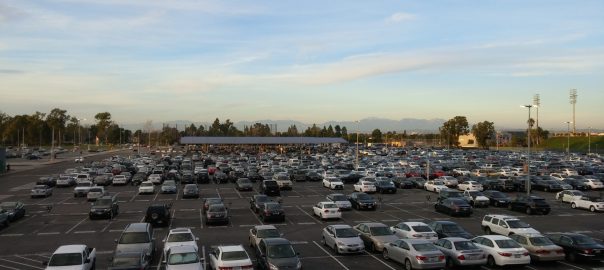
And while you’re riding on campus, keep an eye out (and advocate!) for other improvements the campus is considering: mobility hubs (large bike / skateboard parking areas, complete with security cameras and seating), improved safety in parking lots (e.g., sharrows to mark routes through the lots, hopefully followed by wide shared-use pathways along the sides of the Adams and Merrimac lots), skateboard parking racks near buildings, and bike repair services.  If you’re interested in helping plan, find funding, and/or advocate for these changes on campus, drop me a line!

bike path on campus
Near the Arts Center.
Person on bike in a street next to a Sharrow.

Costa Mesa City Council adopts the Active Transportation Plan

[For more background on Costa Mesa’s new Active Transportation Plan, see my five-part series on the plan.]

After more than an hour and a half of presentations, public comments, and discussion, the Costa Mesa City Council adopted the city’s draft Active Transportation Plan at their meeting last night.  The vote was 4-1 in favor, with Mayor Genis and Council members Foley, Righeimer, and Stephens voting in favor and Mayor Pro Tem Mansoor voting against the motion.

This is an exciting moment for users of active transportation in Costa Mesa, as the new plan includes proposals for dozens of miles of new or improved facilities for people who get around by bike, foot, or other forms of active transportation.

To illustrate the change this plan could bring about, here was the state of the city’s active transportation infrastructure last year:

map of existing bike routes in Costa Mesa
Map of Costa Mesa’s existing bike routes, from the October 2017 draft of the Costa Mesa Active Transportation Plan. Red lines are Class I facilities, blue lines are Class II, and green lines are Class III bike routes.

Of note is that there are many gaps in the city’s active transportation infrastructure, and that most of the city’s existing facilities are on-street bike lanes (indicated as blue lines on the map) or bike routes (green lines) that lack any protection from cars besides paint.

With that context, the plan the City Council adopted is a stunning improvement:

Map of existing and proposed active transportation facilities in Costa Mesa in the May 2018 version of the city’s draft Active Transportation Plan, as presented to the Costa Mesa Planning Commission. Red lines are Class I (off-street multi-use trails), blue lines are Class II (bike lanes), green lines are Class III (bike routes), purple lines are Class III (bike boulevards), and yellow lines are Class IV (protected bikeways).

The new plan includes a tremendous amount of connectivity – users of active transportation wanting to get from one part of the city to another will be able to do so on facilities that link together seamlessly.  Additionally, the plan includes the creation of roughly 15 miles of protected bike lanes and off-street multi-use trails, where bicyclists and other active transportation users are protected from cars by solid barriers or curbs.  These improvements should dramatically increase the appeal of active transportation to residents of the city, thus helping reduce traffic in Costa Mesa and helping our residents be happier, healthier, and more engaged (as users of active transportation tend to be more locally-focused).

The only major change made to the plan at the meeting was the deletion of the Class I trail extending from the end of 19th Street through Talbert Regional Park to the Santa Ana River Trail, due to that area being subject to county planning, not city planning.

While we should celebrate this moment, a great plan is, of course, only the start: the city and its residents now need to prioritize and fund these projects, to help make the bright future this plan presents to us a reality.

Image of bike paths in Costa Mesa

Changes to the Costa Mesa Active Transportation Plan as it heads to the City Council

[This is the fifth article in a series. The first article summarizes Costa Mesa’s draft active transportation plan, the second article discusses the proposed Tanager Drive Trail extension and Fairview Park multi-use trails, the third article discusses the plan’s implications for Orange Coast College, and the fourth article is an update on the Tanager Drive Trail extension. The plan was adopted by the City Council in June 2018.]

Diagram showing bike lanes in the city of Costa Mesa
The map of existing and proposed active transportation facilities in the May 2018 version of the draft Costa Mesa Active Transportation Plan, as presented to the Costa Mesa Planning Commission. Document obtained from the planning commission’s May 14 agenda.

Costa Mesa’s draft Active Transportation Plan heads to the City Council this Tuesday (June 5) for consideration, after having been recommended for adoption by the City’s Planning Commission at their May 14 meeting.

The active transportation plan, as approved by the Planning Commission, has had a few changes since I last summarized it back in December (using information from the August  2017 draft):

1) The Tanager Drive Trail Extension, which would have run behind houses along Tanager Drive on the northern edge of the Costa Mesa Golf Course, has been removed from the plan.  Additional Class III Bike Boulevards on the neighborhood streets nearby have been added (along Cardinal Drive and Swan Circle), essentially in line with Bill Burke’s, Mike Chun’s, and my joint letter.  This change was approved by the city’s Bikeway and Walkability Committee at their April 4 meeting, apparently after the city had received additional feedback from local residents against the proposed trail extension.

2) The The Airport Channel / Delhi Channel Class I Off-Street Multi-Use Trail, which would have created a bicycle and pedestrian crossing of the 405 in the northeastern portion of the city, has been removed from the map but left in the text of the plan.  I hope that this facility is able to remain a portion of the plan, as even though a Class I off-street multi-use trail in the area and bridge over the 405 would clearly be expensive and difficult to build, a safe crossing of the 405 in that area of Costa Mesa would dramatically improve active transportation in the region (just as the Santa Ana River Trail’s safe undercrossing of the 405 in western Costa Mesa has done for that side of the city).

3) The August draft left a gap in bike infrastructure along Pomona Avenue between Hamilton and 19th; in the revised plan this has been filled by the addition of a Class III bike route on the street.  Given that this is the very area where a driver nearly hit a group of OCC bicyclists a few weeks ago, this is a needed change.

4) A Class III bike route was added to the streets (Royal Palm, Mace, Caraway, and Cinnamon) just west of Harbor Boulevard between Gisler and Adams, with the goal of providing cyclists an alternate to southbound Harbor Boulevard in that region of Costa Mesa.  Nicknamed by some the “In-N-Out Trail,” this will allow cyclists to travel all the way from In-N-Out (Gisler and Harbor) nearly to Wilson on safer side streets, avoiding two miles of busy Harbor Boulevard without adding much distance (less than three-quarters of a mile extra travel).

5) The eastern edge of Gisler has had a Class I off-street multi-use trail connection to Fairview added, which will make Gisler a much more useful street for cyclists.  Given that there is already a paved walking path already in existence in this area, this doesn’t seem like much of a change.

6) A notation has been added that “All trails within Fairview Park shall conform and be implemented per specification in the Fairview Park Master Plan.”

Here’s a marked-up map showing the location of the changes:

Image of bike paths in Costa Mesa
The map of existing and proposed active transportation facilities in Costa Mesa in the May 2018 version of the city’s draft Active Transportation Plan, as presented to the Costa Mesa Planning Commission. Changes from the same image in the August 2017 draft of the plan have been highlighted (green are additions, red are deletions).
Harbor Blvd. entrance to the Tanager Drive Trail

Tanager Drive Trail extension update

[This is the fourth article in a series. The first article summarizes Costa Mesa’s draft active transportation plan, the second article discusses the proposed Tanager Drive Trail extension and Fairview Park multi-use trails, the third article discusses the plan’s implications for Orange Coast College, and the next article summarizes changes to the plan as it progressed through city committees. The plan was adopted by the City Council in June 2018.]

During the Bikeway and Walkability public outreach session on Wednesday December 6, Bill Burke, a resident of Tanager Drive, used his public comment time to address my post on the proposed Tanager Trail extension. Bill, and many of his neighbors, attended the meeting to speak in favor of the overall active transportation plan, but against putting an off-street multi-use trail behind their houses. After the meeting we were able to talk, and I met with him and Mike Chun the following Saturday to discuss active transportation in and around the Tanager Drive area.

The goal of this meeting was to give us an opportunity to share our personal views and experiences, and help us understand the issues better. I came out of the meeting with a much better understanding of their concerns, and a revised view of the situation.

Connections through the Upper Birds

A starting point for discussing active transportation in this area of Costa Mesa is to look at all the connections that are served by the roads and trails in the Upper Birds neighborhood:

Marked up Google Map
A diagram illustrating the connections around the Upper Birds neighborhood in Costa Mesa. Map from Google Maps in December 2017.
  • Directly to the southwest is Fairview Park, a prime destination in the area as well as home to a very useful connection to the Santa Ana River Trail and Huntington Beach.
  • Also to the southwest is Placentia Avenue, which connects to homes, shopping, schools, and more.
  • To the northwest are homes in Mesa Verde, Estancia Park, Adams Avenue (which leads to Huntington Beach), and additional connections to the Santa Ana River Trail (at Gisler or Moon Park) for those traveling north.
  • To the southeast is the existing Tanager Drive Trail, which connects to the Harbor Village Apartments, Harbor Boulevard (for shopping and more), the homes in College Park, and Orange Coast College.
  • To the northeast, along Golf Course Drive and Mesa Verde East, are connections to shopping, additional residences (including the eastern part of Mesa Verde and the many apartments at 27 Seventy Five Mesa Verde), and another route to Orange Coast College.

Creating quality active transportation connections through this neighborhood will allow people traveling between all these points to do so more safely and easily. Students traveling between Orange Coast College and Huntington Beach, people heading to Fairview Park, folks heading to shopping near the Harbor and Adams intersection, commuters on their way to work, families out for a trip to the beach, and more could all use a connection in this region. But currently it’s not at all clear how to navigate the neighborhood (e.g., I had a student who lived in this neighborhood for more than a year but didn’t realize that the Tanager Drive Trail existed).

Off-street multi-use trail

A way to link all of those destinations in a clear, easy-to-navigate manner would be to create an off-street multi-use trail along the north side of the golf course, as discussed in this post.

Something I made clear when talking with Bill and Mike, and want to make clear here, is that while discussing a proposed extension of the Tanager Drive off-street multi-use trail I am not talking about building a “caged bike trail” that is a narrow strip of bumpy asphalt dominated by a looming chain-link fence. I would be opposed to building such a structure; fenced-in, narrow trails are, among other problems, unsightly (to both trail users and local residents) and unwelcoming to many potential trail users.

When I see plans to put a Class I trail on the north side of the golf course, I see a trail like the one just north of Castaways Park, or the San Diego Creek Trail, or the Harbor Cornerstone Trail: beautiful, wide, nicely lit, well-landscaped trails that are welcoming to all and are designed in such a way as to deter crime to the adjacent properties (e.g., by putting dense vegetation adjacent to property fence lines).

But what I envision may not be feasible in anything approaching the short term. Continue reading Tanager Drive Trail extension update

The Adams Parking Lot of Orange Coast College.

Costa Mesa’s draft Active Transportation Plan: Benefits for OCC

[This is the third article in a series. The first article summarizes Costa Mesa’s draft active transportation plan, the second article discusses the proposed Tanager Drive Trail extension and Fairview Park multi-use trails, the next article is an update on the Tanager Drive Trail extension, and the fifth article summarizes changes to the plan as it progressed through city committees. The plan was adopted by the City Council in June 2018.]

I’ve taught at Orange Coast College for fifteen years, and for all of those years I’ve lived within walking and biking distance of the campus. Being able to bike or walk to work every morning has been a tremendous asset in my life; instead of sitting in traffic fuming, I get to start every day with a short ride or walk through the pleasant Costa Mesa weather, possibly stopping in a park to enjoy my tea if I’ve got a bit of extra time. I’m happier, healthier, and fitter (and a better teacher) thanks to biking and walking to work.

Existing active transportation facilities near Orange Coast College

But actually getting to OCC by biking or walking right now is … not trivial. The city’s existing active transportation infrastructure has significant gaps around the campus – take a look at how few connections there are to OCC with the current infrastructure (especially from the north):

Map of facilities around OCC.
The existing active transportation facilities around Orange Coast College, as seen in the August 2017 draft of the Costa Mesa Active Transportation Plan. Red lines are off-street multi-use trails, blue lines are bike lanes, and green lines are bike routes.

Proposed new facilities near Orange Coast College

The most recent draft active transportation plan the city has posted online includes many proposals that are relevant to Orange Coast College:

Existing and proposed bike facilities around OCC
The proposed active transportation facilities around Orange Coast College, as seen in the August 2017 draft of the Costa Mesa Active Transportation Plan. Red lines are off-street multi-use trails, blue lines are bike lanes, yellow lines are protected bikeways, green lines are bike routes, and purple lines are bicycle boulevards. Solid lines are existing facilities, dashed lines are proposed new facilities.

[Note: For more background on the difference between off-street multi-use trails, bike lanes, protected bikeways, bike routes, and bicycle boulevards, see my summary post on the draft Active Transportation Plan.]

There are many improvements relevant to OCC, which I’ll cover by general location. Continue reading Costa Mesa’s draft Active Transportation Plan: Benefits for OCC

Proposed trail location on the north edge of the golf course.

An examination of the proposals around Tanager Drive in Costa Mesa’s draft Active Transportation Plan

[This is the second article in a series. The previous article summarizes Costa Mesa’s draft active transportation plan, the next article discusses the plan’s implications for Orange Coast College, the fourth article is an update on the Tanager Drive Trail extension, and the fifth article summarizes changes to the plan as it progressed through city committees. The plan was adopted by the City Council in June 2018.]

In this article I will discuss the current state of active transportation (walking, bicycling, jogging, etc.) infrastructure on the northern side of the Costa Mesa Golf Course and Fairview Park, and then go over the proposals included in the city’s draft active transportation plan.

To jump straight to the discussion of the proposals, click here

Existing facilities in the region

map of costa mesa bike facilities
The existing active transportation facilities around Fairview Park, as seen in the August 2017 draft of the Costa Mesa Active Transportation Plan. Red lines are off-street multi-use trails; blue lines are bike lanes

The current facilities in the region include:

  • The Tanager Drive off-street multi-use trail
  • The Fairview Park off-street multi-use trails

Existing Tanager Drive Trail

Tanager Drive Trail
Existing Tanager Drive Trail

The Tanager Drive Trail is an off-street multi-use trail leading from Harbor Boulevard to Golf Course Drive. The trail runs along the northern border of the Harbor Village apartments and the northeastern border of the Costa Mesa Golf Course. The trail was recently repaved, and is frequently used by local residents (including yours truly, who bikes to work on it most days).

Harbor Blvd. entrance to the Tanager Drive Trail

The Tanager Drive Trail connects with the Harbor Cornerstone Trail, which connects to the Joann Street Trail, allowing people to easily access the Tanager Drive Trail from multiple areas of Harbor Boulevard.

Eastern entrance to the Tanager Drive Trail

The end of the Tanager Drive Trail at Golf Course Drive is not well-marked, leading many people to be unaware that there is a multi-use trail open to the public at that location. The lack of good marking also makes it a dangerous location to enter the trail; I’ve almost been hit there on my bike by vehicles exiting the golf course. Continue reading An examination of the proposals around Tanager Drive in Costa Mesa’s draft Active Transportation Plan

Harbor Blvd. Bike Trail at night

Costa Mesa’s draft Active Transportation Plan: A summary

Cover of the 2017 transportation plan.
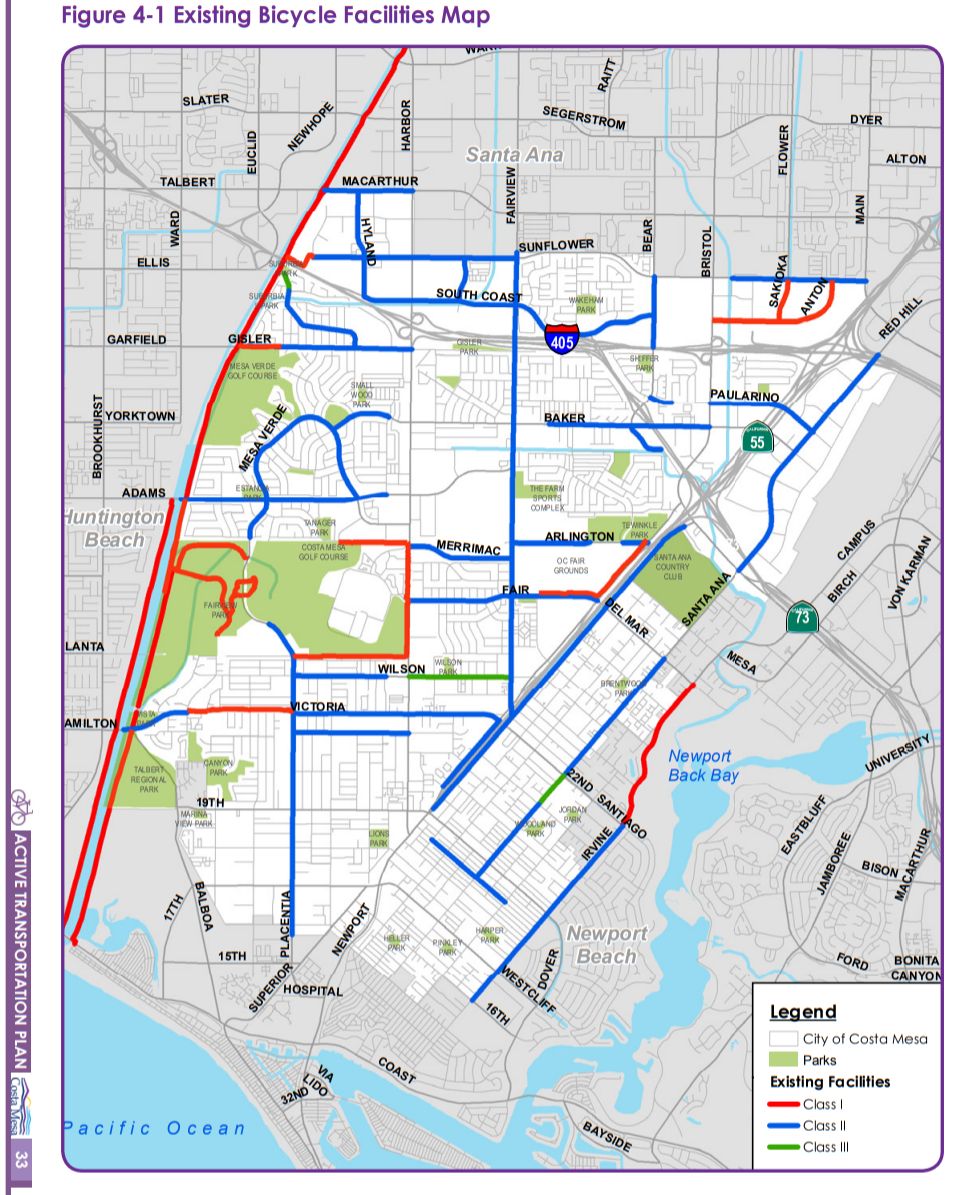
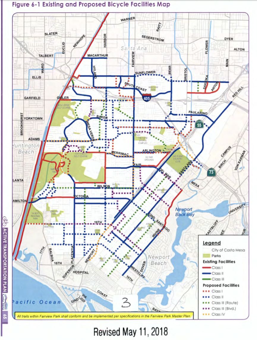
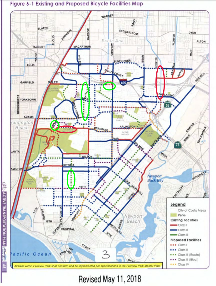
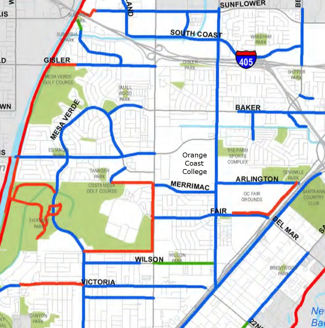
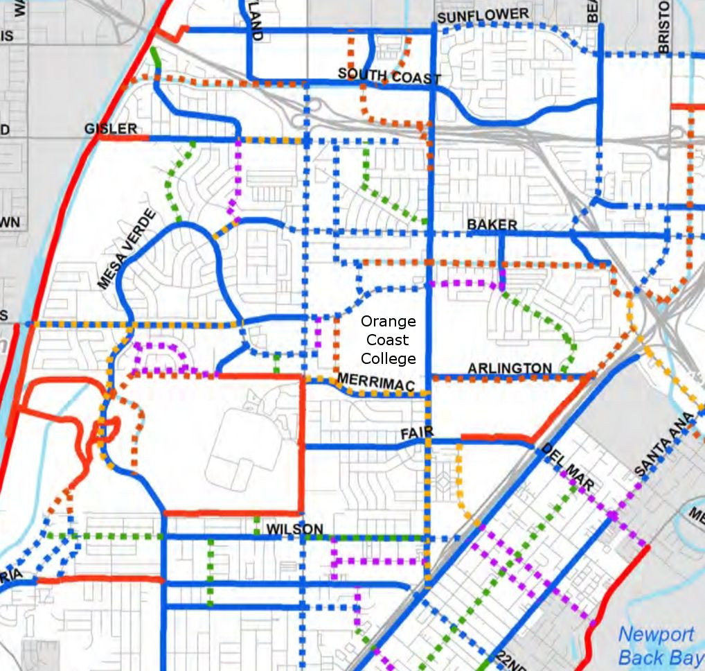
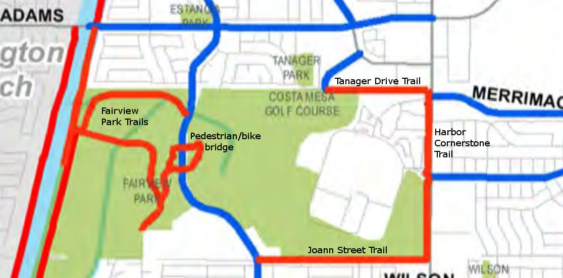
[This is the first article in a series on Costa Mesa’s draft Active Transportation Plan.  The next article discusses the
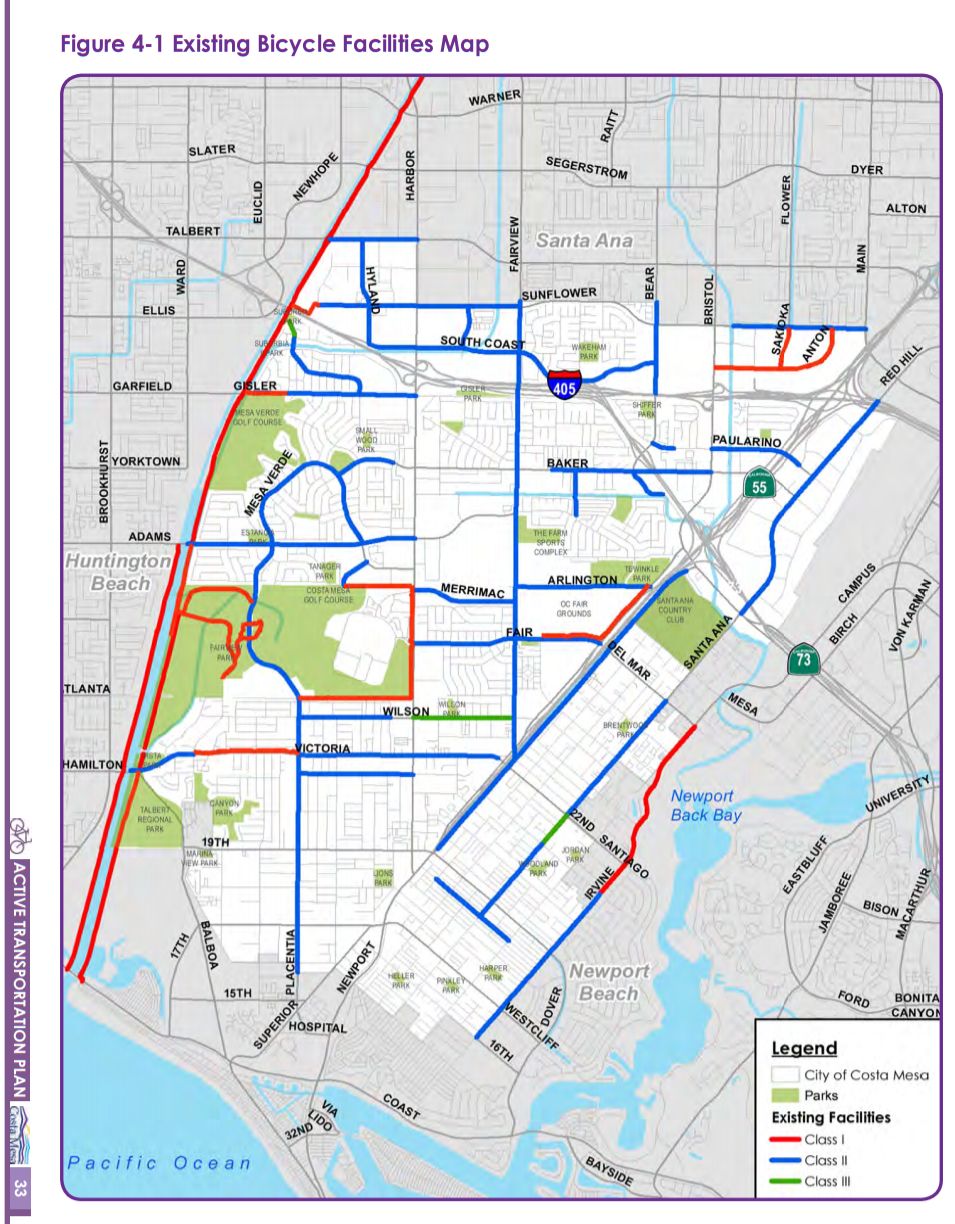
 proposed Tanager Drive Trail extension and Fairview Park multi-use trails, the third article discusses the plan’s implications for Orange Coast College, the fourth article is an update on the Tanager Drive Trail extension, and the fifth article summarizes changes to the plan as it progressed through city committees.  The plan was adopted by the City Council in June 2018. ]

The city of Costa Mesa is working on a new active transportation plan. The plan is being drafted by Stantec, with input from city residents, city staff, and the city’s Bikeway and Walkability committee. The most recent version of the plan available online is the August 2017 draft.

The Bikeway and Walkability Committee is currently soliciting public input on the plan, with the second of two public outreach sessions happening Wednesday, December 6, 2017 at 7:00pm in conference room 1A at Costa Mesa City Hall.

To help people understand this new plan, which is more than 75 pages long, I’ll try to summarize some of the key elements in this post.

Existing infrastructure

The city currently has 43.5 miles of bike routes, though only nine of those are Class I (off-street) bicycle paths that completely separate cyclists from traffic; most of the rest are bike lanes painted on the edge of roadways.

A map of Costa Mesa, CA showing bike paths.
Map of Costa Mesa’s existing bike facilities, from the August 2017 draft of the Costa Mesa Active Transportation Plan. Red lines are Class I (off-street multi-use trails), blue lines are Class II (bike lanes), and green lines are Class III (bike routes).

Types of bicycle paths

Here’s what the colored lines on that map mean:

Class I: off-street multi-use trail

Person on bike on Class I bike path.
A person on a bike rides along the Harbor Cornerstone Bike Trail in Costa Mesa.

Indicated on the map with red lines, these are pathways that completely separate the people on them from motor vehicle traffic. These are by far the most welcoming to people of all ages and all skill levels, such as children, inexperienced bicyclists, or people with disabilities. Class I trails are not just for cyclists: dog walkers, roller skaters, joggers, kids on scooters, and everyone else can use them too.

The shining star of Class I bicycle paths in Costa Mesa is the Harbor Boulevard Cornerstone Trail, built in 2016, that runs along Harbor between Merrimac and Fair.

Some of the best cycling/walking/recreational areas in the county are anchored by Class I trails: Newport Back Bay, the San Diego Creek Trail, Castaways Park, and more.

Bike trail on cliffs above water.
The trail that leads north out of Castaways Park heads along the cliffs above Newport Back Bay and behind some gorgeous homes. It’s a beautiful example of a Class I trail.
lights illuminate the fog-shrouded bike trail.
A foggy evening on the San Diego Creek Trail in Irvine.

Class II: bike lanes

Continue reading Costa Mesa’s draft Active Transportation Plan: A summary

Map for my Costa Mesa to Newport Back Bay loop. Map data from Google 2016; ride details from RideWithGPS.

Ride: Newport Back Bay loop from Costa Mesa

Introduction

Newport Back Bay seen from Castaways Park.

Newport Back Bay is a gem of central Orange County.   It’s a wetlands estuary located just inland from Newport Harbor, and has roughly six miles of paved bike path that allow you to ride only feet away from nature.  The views can be gorgeous, and I’ve seen many stunning sunsets while riding it.

For years I suggested that my students do an outdoor project at Newport Back Bay, and many came back saying “I never knew this was there; I loved it!”

However, actually cycling around Newport Back Bay is more complicated than it should be because the bicycle path does not actually form a complete loop around the bay.  On the eastern side the bike trail ends about a quarter mile north of PCH, and then doesn’t truly start up again until about a mile and a half north of PCH on the western side.  Thus, riders wanting to do a true loop must fend for themselves and figure out how to get through PCH and city streets to get back to the trail.

Route

I’ve created a complete loop with detailed notes in RideWithGPS: Costa Mesa -> Newport Back Bay Loop, and embedded a live view of the route below.  When starting from Estancia Park in Costa Mesa the route is just about 19 miles round trip and gains a total of 450 feet of elevation. Continue reading Ride: Newport Back Bay loop from Costa Mesa

Gisler Ave. connects to SART via a cool little bridge, seen here from on the trail itself.

Entering and exiting the Santa Ana River Trail in Costa Mesa

The length of the Santa Ana River Trail in Costa Mesa. Image from GoogleMaps
The length of the Santa Ana River Trail  in Costa Mesa (highlighted in blue). Image and map data from Google 2015; click for a larger version.

I live in Costa Mesa and love riding on the Santa Ana River Trail (SART), a multiuse paved trail open to walkers, runners, bicyclists, skaters, and more (pretty much anything non-motorized). If you’ve never ridden it before, you’ve got to: the Santa Ana River Trail runs more than 30 miles inland from the Pacific Coast Highway (PCH) in Huntington Beach, where it connects up seamlessly with the beach’s bicycle path. And for that length it’s 100% car and crossing free – you have dozens of miles of paved trail to roll on continuously without stopping.  Insanely useful for getting places in central Orange County while avoiding cars.

But getting on the trail isn’t always intuitive, especially as the trail crosses  from one side of the river to the other within Costa Mesa’s borders. Starting near the ocean and heading inland, here are all the entrances from Costa Mesa:

The Santa Ana River Trail between Victoria/Hamilton and the beach is beautiful at high tide.

I’ve also included two bonus entrances for people coming from Huntington Beach:

And I also point out where the bridge is:

PCH / southern end of Huntington State Beach

The PCH and Huntington State Beach entrance to the Santa Ana River Trail. Image and map data from Google Maps 2015.
The PCH and Huntington State Beach entrance to the Santa Ana River Trail; entrances are circled in green. Image and map data from Google 2015.

Continue reading Entering and exiting the Santa Ana River Trail in Costa Mesa