- Introduction
- Route
- Sights to expect
- Bathrooms, water, and rest stops
- Route notes
- Riding surface
- Safety
Introduction
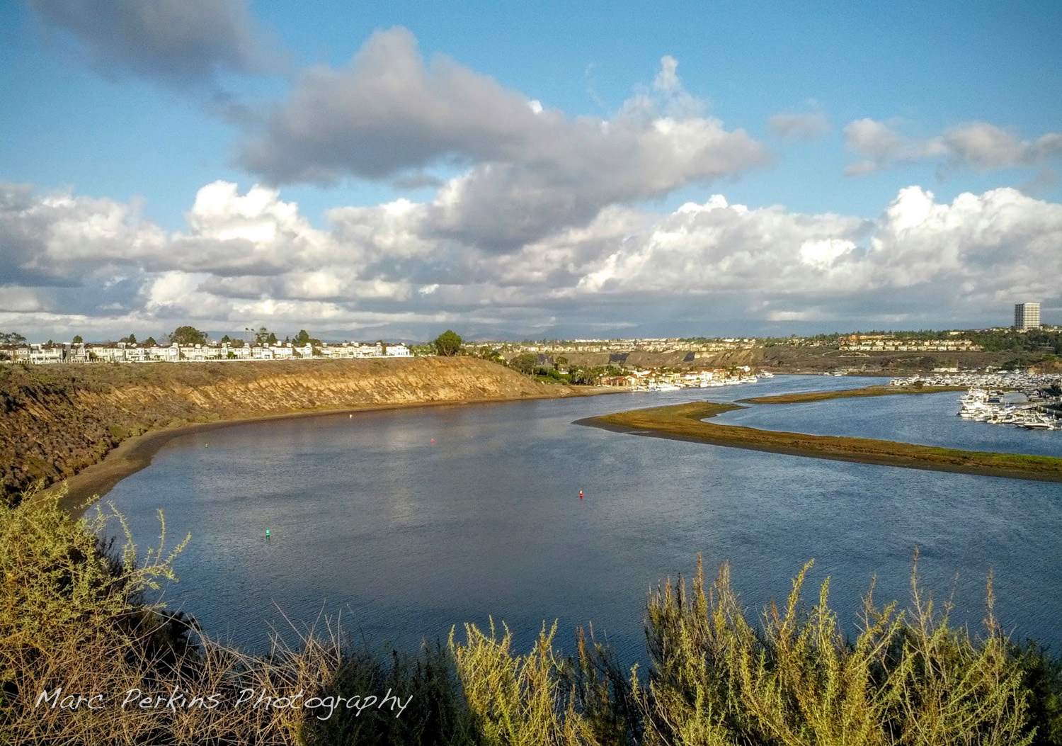
Newport Back Bay is a gem of central Orange County. It’s a wetlands estuary located just inland from Newport Harbor, and has roughly six miles of paved bike path that allow you to ride only feet away from nature. The views can be gorgeous, and I’ve seen many stunning sunsets while riding it.
For years I suggested that my students do an outdoor project at Newport Back Bay, and many came back saying “I never knew this was there; I loved it!”
However, actually cycling around Newport Back Bay is more complicated than it should be because the bicycle path does not actually form a complete loop around the bay. On the eastern side the bike trail ends about a quarter mile north of PCH, and then doesn’t truly start up again until about a mile and a half north of PCH on the western side. Thus, riders wanting to do a true loop must fend for themselves and figure out how to get through PCH and city streets to get back to the trail.
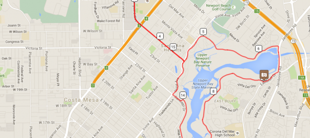
Route
I’ve created a complete loop with detailed notes in RideWithGPS: Costa Mesa -> Newport Back Bay Loop, and embedded a live view of the route below. When starting from Estancia Park in Costa Mesa the route is just about 19 miles round trip and gains a total of 450 feet of elevation. Continue reading Ride: Newport Back Bay loop from Costa Mesa