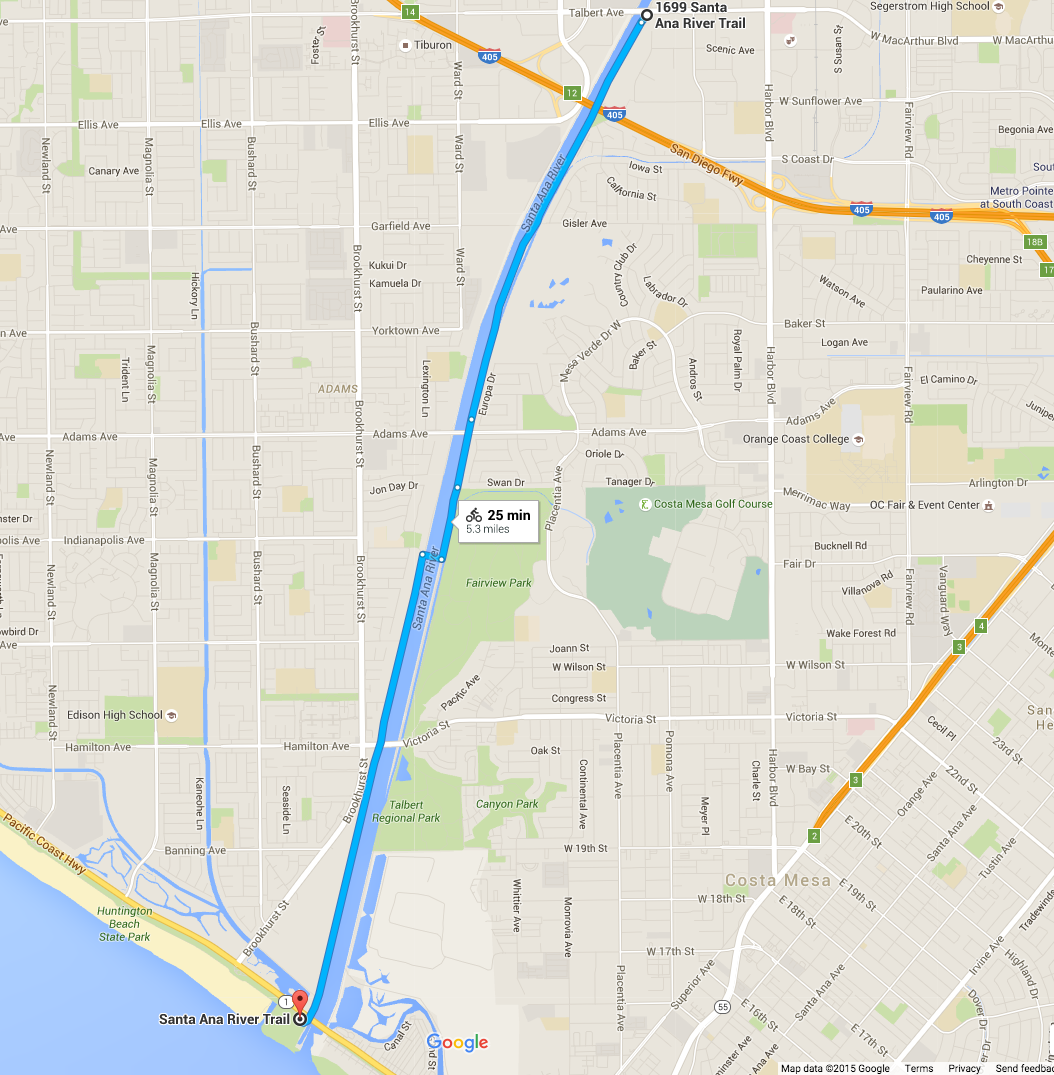
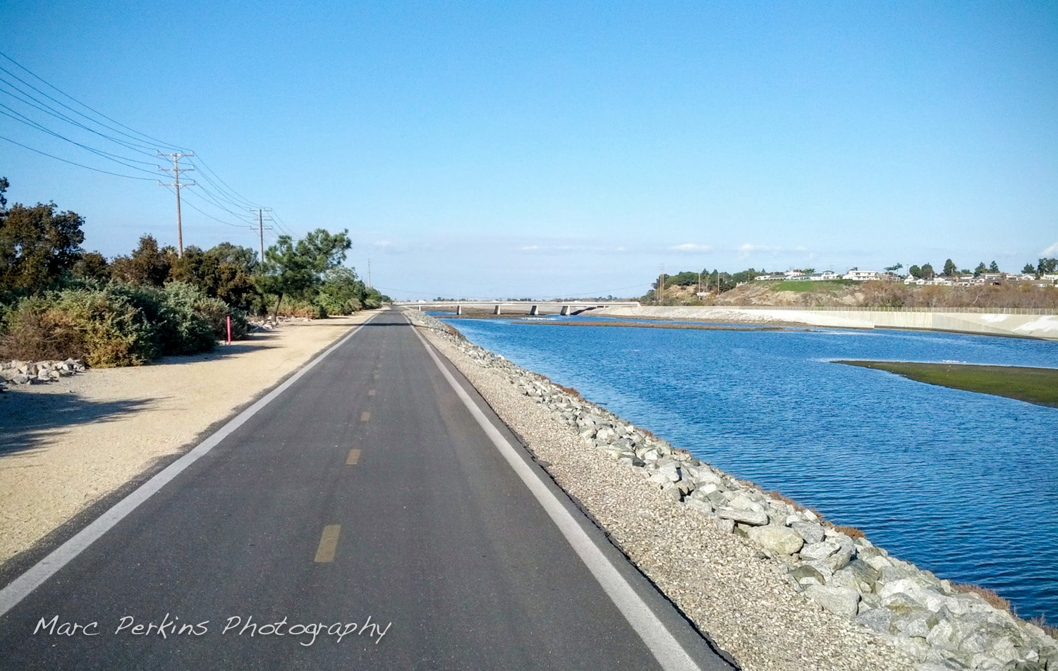
I live in Costa Mesa and love riding on the Santa Ana River Trail (SART), a multiuse paved trail open to walkers, runners, bicyclists, skaters, and more (pretty much anything non-motorized). If you’ve never ridden it before, you’ve got to: the Santa Ana River Trail runs more than 30 miles inland from the Pacific Coast Highway (PCH) in Huntington Beach, where it connects up seamlessly with the beach’s bicycle path. And for that length it’s 100% car and crossing free – you have dozens of miles of paved trail to roll on continuously without stopping. Insanely useful for getting places in central Orange County while avoiding cars.
But getting on the trail isn’t always intuitive, especially as the trail crosses from one side of the river to the other within Costa Mesa’s borders. Starting near the ocean and heading inland, here are all the entrances from Costa Mesa:
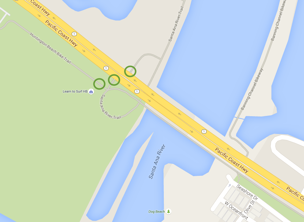
- PCH / southern end of Huntington State Beach
- Victoria St.
- Fairview Park
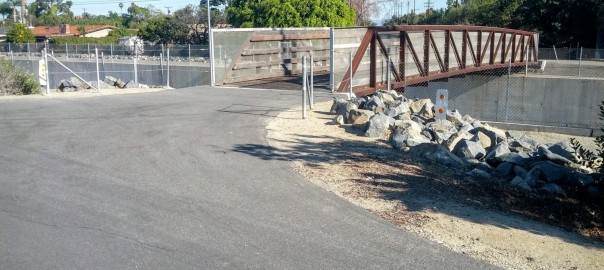
- Adams Ave.
- Gisler Ave.
- Moon Park
- Sunflower Ave.
- MacArthur Blvd.
I’ve also included two bonus entrances for people coming from Huntington Beach:
And I also point out where the bridge is:
PCH / southern end of Huntington State Beach
Continue reading Entering and exiting the Santa Ana River Trail in Costa Mesa