[This is the second article in a series. The previous article summarizes Costa Mesa’s draft active transportation plan, the next article discusses the plan’s implications for Orange Coast College, the fourth article is an update on the Tanager Drive Trail extension, and the fifth article summarizes changes to the plan as it progressed through city committees. The plan was adopted by the City Council in June 2018.]
In this article I will discuss the current state of active transportation (walking, bicycling, jogging, etc.) infrastructure on the northern side of the Costa Mesa Golf Course and Fairview Park, and then go over the proposals included in the city’s draft active transportation plan.
To jump straight to the discussion of the proposals, click here.
Existing facilities in the region
The current facilities in the region include:
- The Tanager Drive off-street multi-use trail
- The Fairview Park off-street multi-use trails
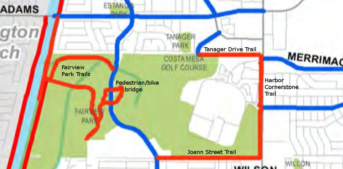
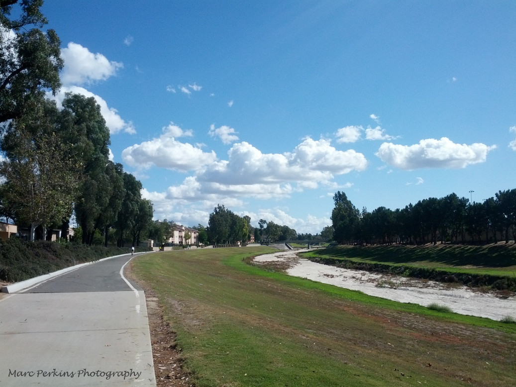
Existing Tanager Drive Trail
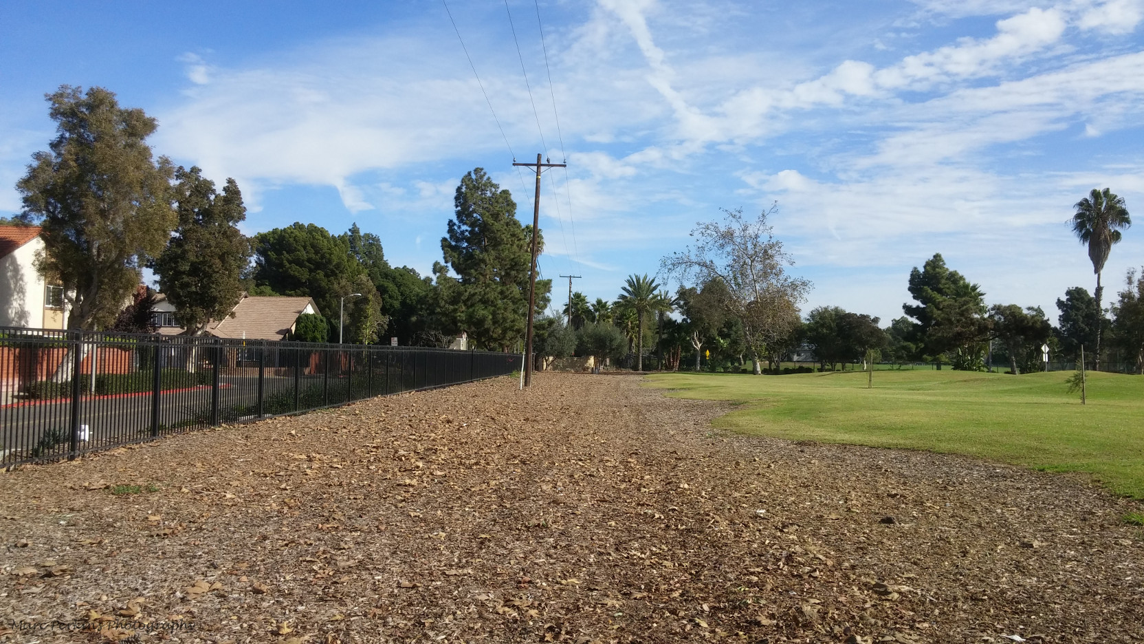
The Tanager Drive Trail is an off-street multi-use trail leading from Harbor Boulevard to Golf Course Drive. The trail runs along the northern border of the Harbor Village apartments and the northeastern border of the Costa Mesa Golf Course. The trail was recently repaved, and is frequently used by local residents (including yours truly, who bikes to work on it most days).
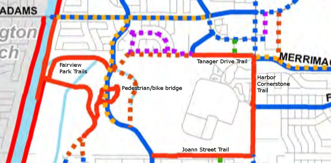
The Tanager Drive Trail connects with the Harbor Cornerstone Trail, which connects to the Joann Street Trail, allowing people to easily access the Tanager Drive Trail from multiple areas of Harbor Boulevard.
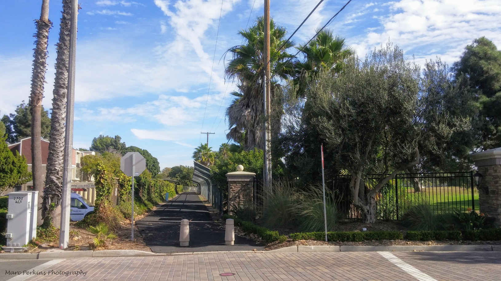
The end of the Tanager Drive Trail at Golf Course Drive is not well-marked, leading many people to be unaware that there is a multi-use trail open to the public at that location. The lack of good marking also makes it a dangerous location to enter the trail; I’ve almost been hit there on my bike by vehicles exiting the golf course.
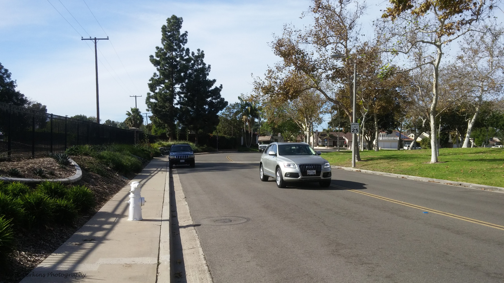
The northeastern edge of Fairview Park is less than half a mile from the end of the Tanager Drive Trail (though there are no signs informing people of this or how to get there). The shortest route to Fairview Park from the end of the trail requires traveling on Tanager Drive, a fairly wide, relatively low-volume city street that runs north of the golf course.
Tanager Drive ends at Canary Drive, which abuts the northern edge of Fairview Park. Thus, walkers and cyclists looking at a map may think that they can enter the park there; however, first-time visitors are greeted with an unpleasant surprise:
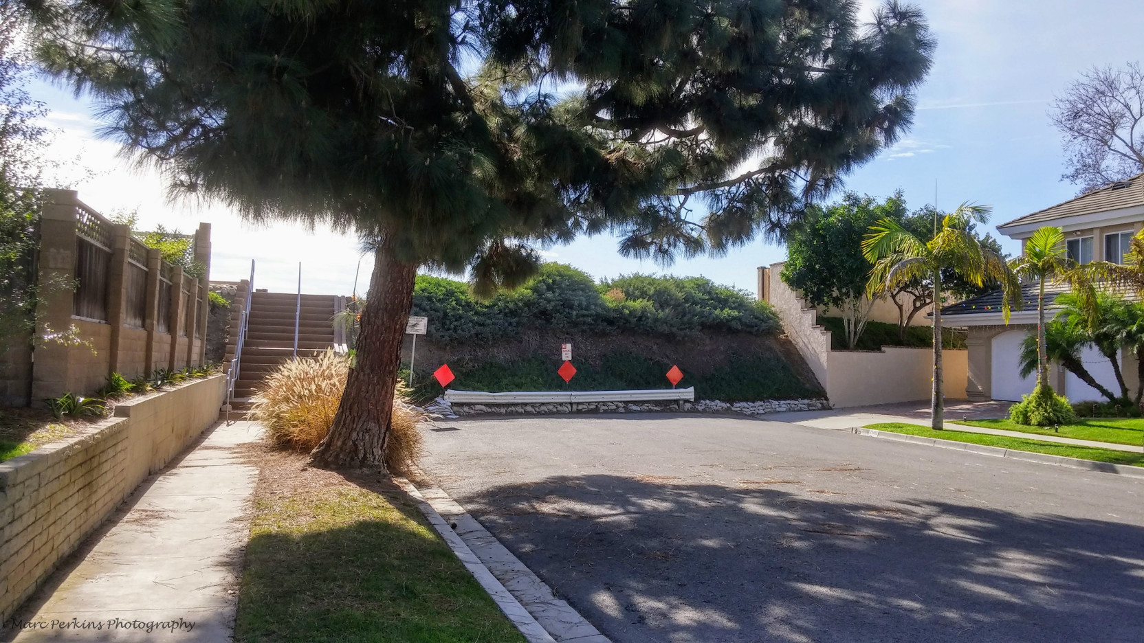
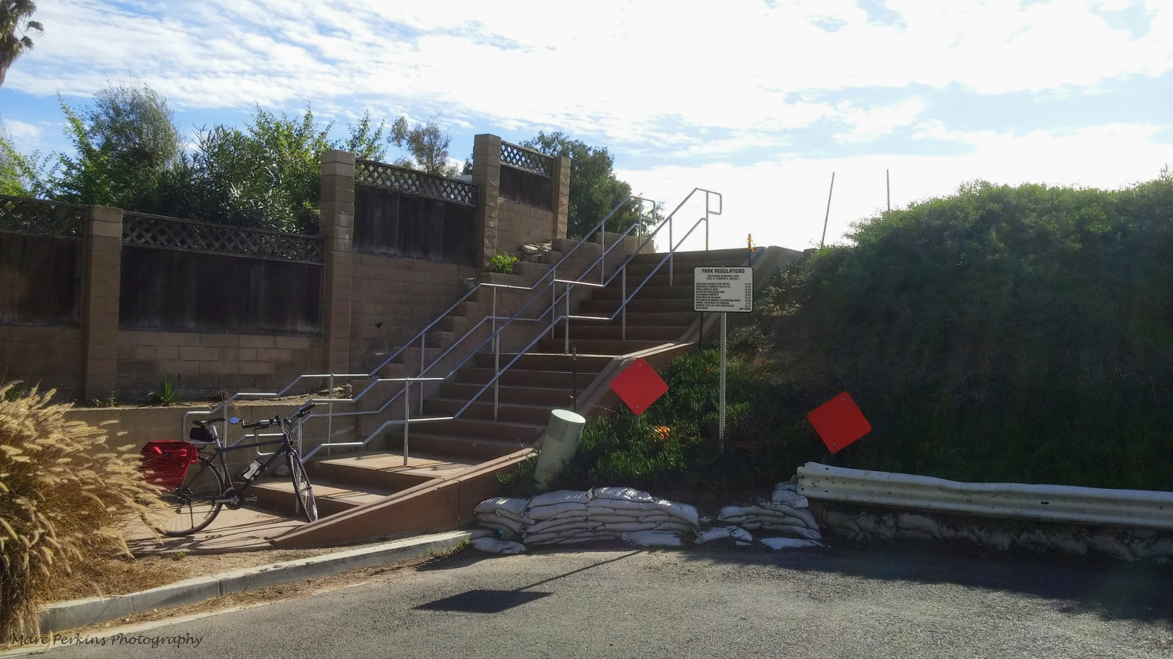
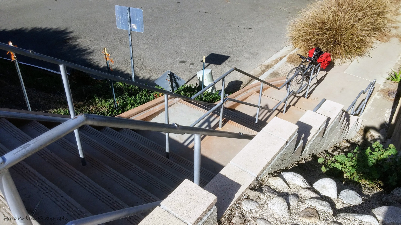
Entering Fairview Park from the end of Canary Drive requires climbing a staircase. This entry to the park is thus only accessible to able-bodied individuals who can climb stairs; people who are unable to climb stairs for whatever reason (e.g., using a wheelchair or pushing a stroller), will be unable to enter the park at this location.
The stairway appears to be designed to allow bicyclists to use it, as one side of the stairway has grooves in the concrete to allow a bike to be rolled up or down the stairs. However, actually rolling a bike up or down this stairway groove is physically challenging (and dangerous!), making this entrance at best inconvenient, or at worst inaccessible to cyclists.
Existing Fairview Park Infrastructure
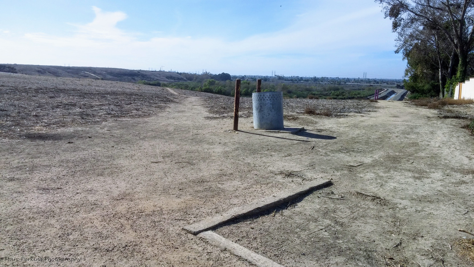
Assuming an individual can navigate the stairs, once in the park they are greeted with multiple dirt trails that they can use. In rainy weather these trails will be muddy, and they’re also uninviting to people using wheelchairs, strollers, roller skates, road bikes, or many other forms of active transportation. There is no signage or wayfinding assistance, and thus it is not clear how (or if it is even possible) to reach the other facilities in the park from that location.
Placentia Avenue is a high-speed street that runs north and south through Fairview Park. Crossing it on a bike or on foot in the Fairview Park region can be challenging. There is an existing pedestrian/cyclist bridge across Placentia that is connected to the off-street, multi-use trails of the park. However, this bridge lacks a paved connection to the Canary Drive entrance to Fairview Park.
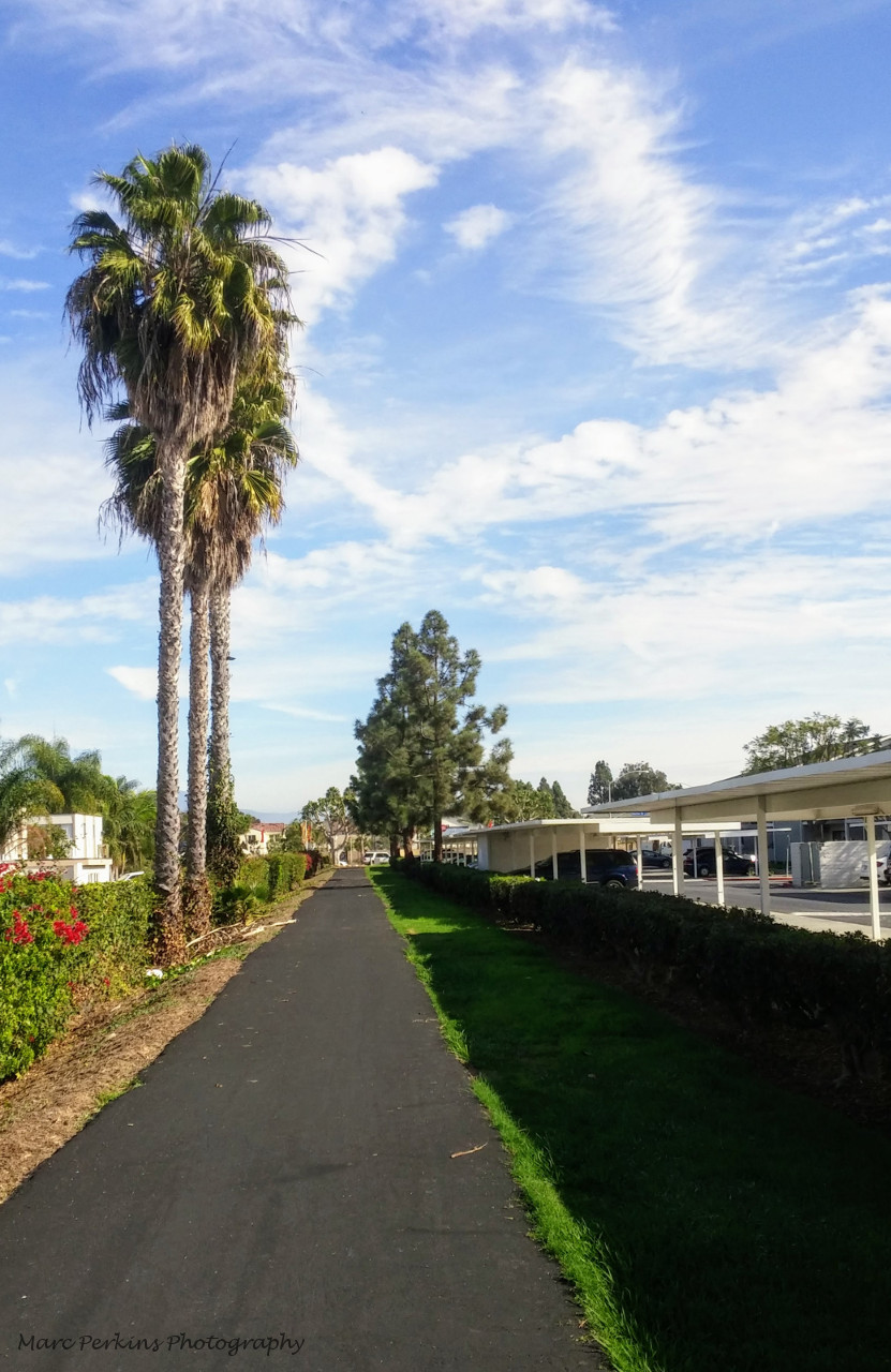
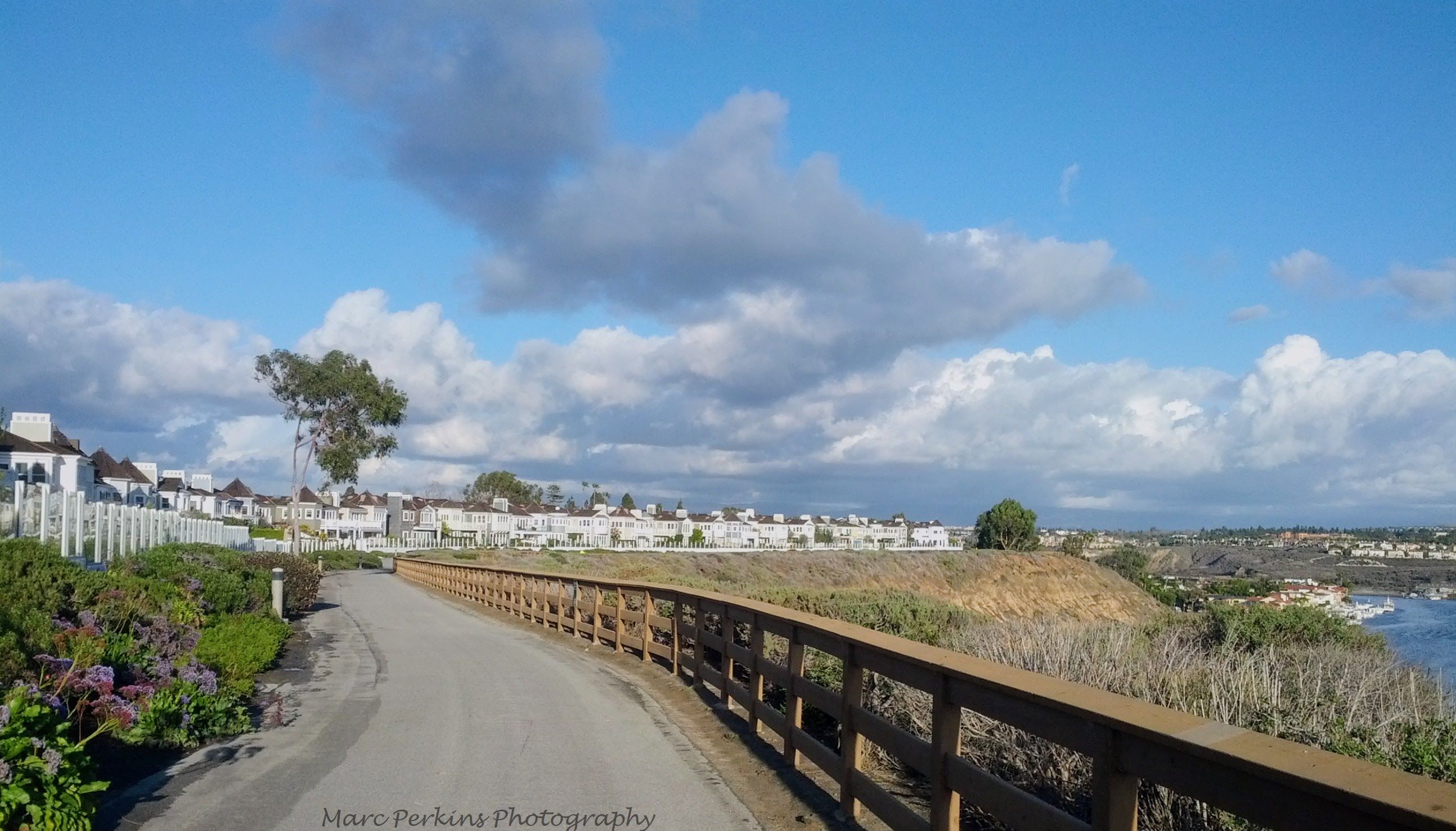
There is an existing off-street, multi-use trail that runs along the northern edge of Fairview Park west of Placentia. This beautiful trail allows everyone in the area north of Fairview Park to easily access the park, and also provides a connection between the Santa Ana River Trail and Placentia (a key link for bicycle commuters and families heading to the beach). However, once people reach Placentia on this trail, they are left with no guidance or assistance at an unprotected crossing, and there is no clear way for them to continue east further into Costa Mesa.
Summary of issues with the existing infrastructure
Currently, there is no good way for users of all ages and abilities to access Fairview Park from the northeastern corner, and the area around the northeastern edge of Fairview Park is a major gap in Costa Mesa’s cycling and walking infrastructure, reducing the usability of the bridge across Placentia, the multi-use trail on the northern edge of Fairview Park west of Placentia, and the Tanager Drive Trail.
Proposals in the August 2017 draft plan
Included in the draft August 2017 proposal are three changes relevant to this area of Costa Mesa:
- Adding additional off-street multi-use trails in Fairview Park
- Adding an off-street multi-use trail on the northern edge of the golf course
- Turning Tanager Drive, Canary Drive, and Oriole Drive into bicycle boulevards
For more background on the difference between off-street multi-use trails and bicycle boulevards, see my summary post on the draft Active Transportation Plan.
What would adding off-street, multi-use trails in Fairview Park and north of the golf course do?
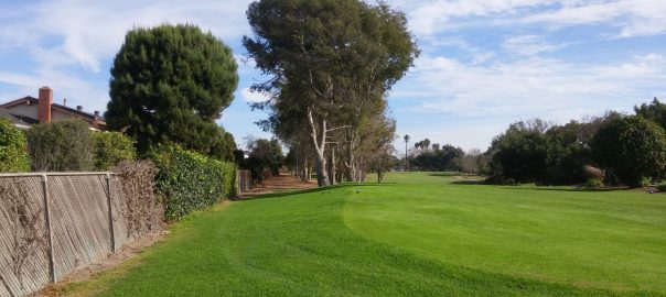
A proposed off-street, multi-use trail would connect the end of the existing Tanager Drive Trail at Golf Course Drive to the northeastern edge of Fairview Park, located along the northern edge of the Costa Mesa Golf Course. The City of Costa Mesa already has a public right of way for the land that this proposed trail is planned to travel on, and the land is currently unused. In fact, you can see that the pathway is visible on the northern edge of the golf course already:
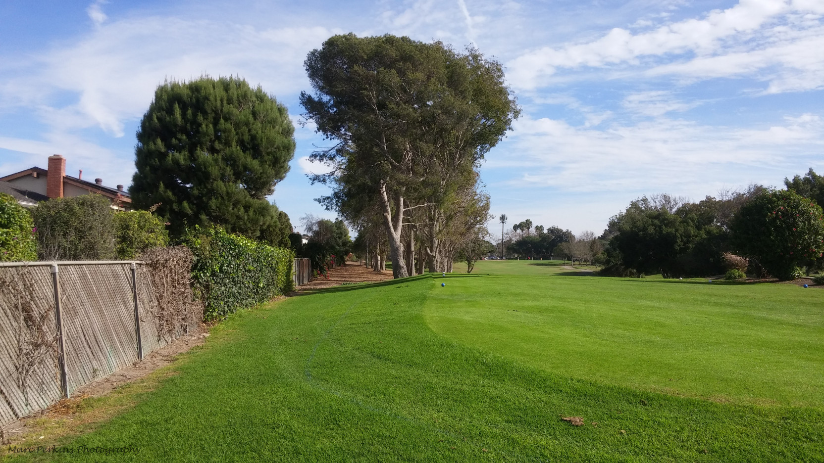
The trail on the northern edge of the golf course would allow people of all ages, abilities, and transportation methods to easily reach Fairview Park without having to worry about stairs or car traffic. This trail would reduce the distance required to enter the park for many city residents; for example, from the end of the existing Tanager Drive Trail at Golf Course Drive:
- With the current infrastructure, it is 4,600 feet to the nearest entrance to Fairview Park usable by all individuals (the northern edge of Fairview Park along Placentia). This two-thirds of a mile route is almost entirely on city streets, and includes a downhill segment.
- After construction of the off-street multi-use trail along the northern edge of the golf course, it would be only 2,300 feet to the nearest entrance to Fairview Park usable by all individuals, and the pathway would be separate from car traffic and level for its entire length.
For residents of College Park and eastern Mesa Verde, especially including apartment complexes like 27 Seventy Five Mesa Verde, this would dramatically improve the accessibility of Fairview Park. It would also improve the ability of residents of those neighborhoods to bicycle to areas south of them in Costa Mesa.
Fairview Park’s northeastern corner would also be much more pleasant, usable, and connected to the rest of the park due to the construction of multiple off-street multi-use trails.
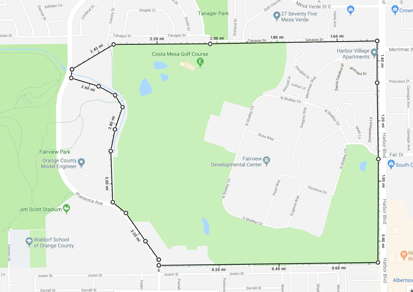
The construction of these new trails would allow people to circumnavigate the golf course and developmental center almost completely on off-street multi-use trails (the fire station on Placentia would have only a sidewalk in front of it), creating a tremendous recreational and active transportation resource; the resulting circuit would be more than three miles long.
What would turning Tanager Drive, Canary Drive, and Oriole Drive into bicycle boulevards do?
Bicycle boulevards are typically used on low-traffic-volume streets where there is not room for another type of bicycle facility. Bicycle boulevards make streets better for cyclists by adding traffic-calming measures, such as speed humps, curb extensions at corners, or traffic circles. They also typically include “sharrows” painted in the center of a lane, indicating that cyclists are encouraged to ride in the center of the lane for safety.
Making these modifications to Tanager, Canary, and Oriole would make these already good streets for cycling even better. However, bicycle boulevards still require people on bikes to ride in the traffic lane, making them unsuitable for many children and inexperienced cyclists.
Converting these streets into bike boulevards would also not improve the connection between Canary Drive and Fairview Park, which only able-bodied pedestrians and bicyclists able to surmount a staircase can currently use.
What if just the Tanager/Canary/Oriole Bike Boulevards were built instead of the off-street multi-use trail north of the golf course?
While Tanager Drive does parallel the proposed new trail on the north of the golf course, and thus pedestrians and bicyclists would not have to go very far out of their way to travel on Tanager instead of the proposed new trail, for the Tanager Drive Bike Boulevard to fill the existing gaps in this region’s active transportation infrastructure, the Canary Drive connection to Fairview Park would need to be modified to be accessible to all. Construction of such an all-user-accessible entrance (e.g., a ramp shallow enough to be usable by those in wheelchairs and wide enough to prevent collisions between travelers) would be challenging, due to the steep slope and presence of houses nearby.
Failure to link up Canary Drive with the Fairview Park trails would make the bike boulevards on Tanager, Canary, and Oriole useful primarily to those living in that particular neighborhood, as the Canary Drive link to Fairview Park is important for creating connections between bicycle trails in the city and providing access to the park.
Conclusion
In my opinion, the addition of off-street multi-use trails running along the northern edge of the golf course and through Fairview Park would provide tremendous benefits to residents of and visitors to Costa Mesa.
Residents near the northeastern corner of Fairview Park (Mesa Verde, College Park) would gain a beautiful trail that would allow users of all ages and abilities to access the park easily and directly.
Residents of the entire city would gain access to a loop of more than three miles of interconnected off-street multi-use trails ringing the golf course and developmental center.
Those using bicycles to travel around Costa Mesa and our neighboring cities would have far more connections to where they want to go, helping not just bicycle commuters but also students, recreational riders, people running errands, families out together, residents heading to their local businesses, and more. As just one example, an Orange Coast College student living in eastern Huntington Beach would, after the plan’s full implementation, be able to ride their bike to campus completely on protected bikeways or off-street multi-use trails.
Addendum
Residents near the proposed golf course trail have expressed concerns about property values declining and crime levels increasing if the trail is built. As a homeowner myself, I completely understand being concerned about property values and crime, and I sincerely hope that the addition of this trail would not bring harm to anyone living in this area. In fact, well-designed multi-use pathways have been shown to raise property values and decrease crime. For instance:
- A 2006 study by the University of Delaware concludes “The majority of studies examined indicate that the presence of a bike path/trail either increases property values and ease of sale slightly or has no effect.”
- A 2006 report for the Rail Trail Conversion Advisory Committee in Massachusetts analyzed home sales in seven towns with multi-use trails, and found that “homes near these rail trails sold at 99.3% of the list price as compared to 98.1% of the list price for other homes sold in these towns … these homes sold in an average of 29.3 days as compared to 50.4 days for other homes.”
- A 2002 study of recent home buyers showed that walking/jogging/bike trails were the second-most desireable community amenity (after “highway access”) for home buyers.
- A 1998 report by the Rails to Trails Conservancy found that “Four separate studies conducted between 1979 and 1997 concluded that rail-trails do not increase crime,” including a report from a trail in Seattle that “the rate of vandalism and break-ins to adjacent property was well below the neighborhood average.”
Nearby areas in Orange County present several examples of well-designed multi-use trails that are an asset to their communities, such as the Newport Back Bay Trail, the trail leading north out of Castaways Park, and the San Diego Creek Trail.
To address concerns about crime, I’d be strongly in favor of creating and enforcing no loitering and no camping laws. The city could also explore innovative solutions, such as the North Augusta Public Safety Department’s integration of their city’s trails into police officers’ physical fitness training, thus adding a regular police presence to the trails at no extra cost (discussed on pg. 12 of the Rails to Trails Conservancy Report).
2 thoughts on “An examination of the proposals around Tanager Drive in Costa Mesa’s draft Active Transportation Plan”