Category Archives: California

Bike path on campus

Orange Coast College Welcomes Students Back with Active Transportation Improvements

Students returning from summer break at Orange Coast College discovered that the campus was adorned with some new paint:
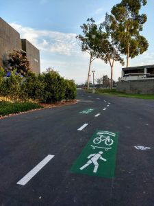
Bike lanes painted on a campus
Orange Coast College’s Wheeled Transportation Loop, seen freshly painted near Allied Health and Technology.

The college first demonstrated this wheeled transportation loop in conjunction with Green Coast Day and Explore Merrimac back in April.  At that time it was marked with spray chalk and temporary signage; due to the success of that demonstration, it’s now marked with paint!
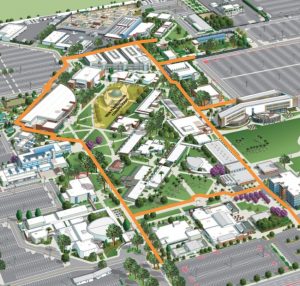
Map of the OCC transportation loop
Map used on Orange Coast College’s “Ride the loop” sign during their April 2018 Wheeled Transportation Loop demonstration.  Due to the construction of the new student center, the lower portion of the loop (that travels through the campus quad) is not able to be painted at this time.

The goal of the loop is to direct people on bicycles and skateboards to wider, safer pathways via clear markings.  Traveling on this loop will allow users of wheeled transportation to traverse the campus in virtually no time, and also to roll to within 100 yards of all campus buildings.  The markings also help alert walkers and other path users to the possible presence of bicyclists and skateboarders (so, to be clear, these are not bike lanes; they’re shared use pathways).
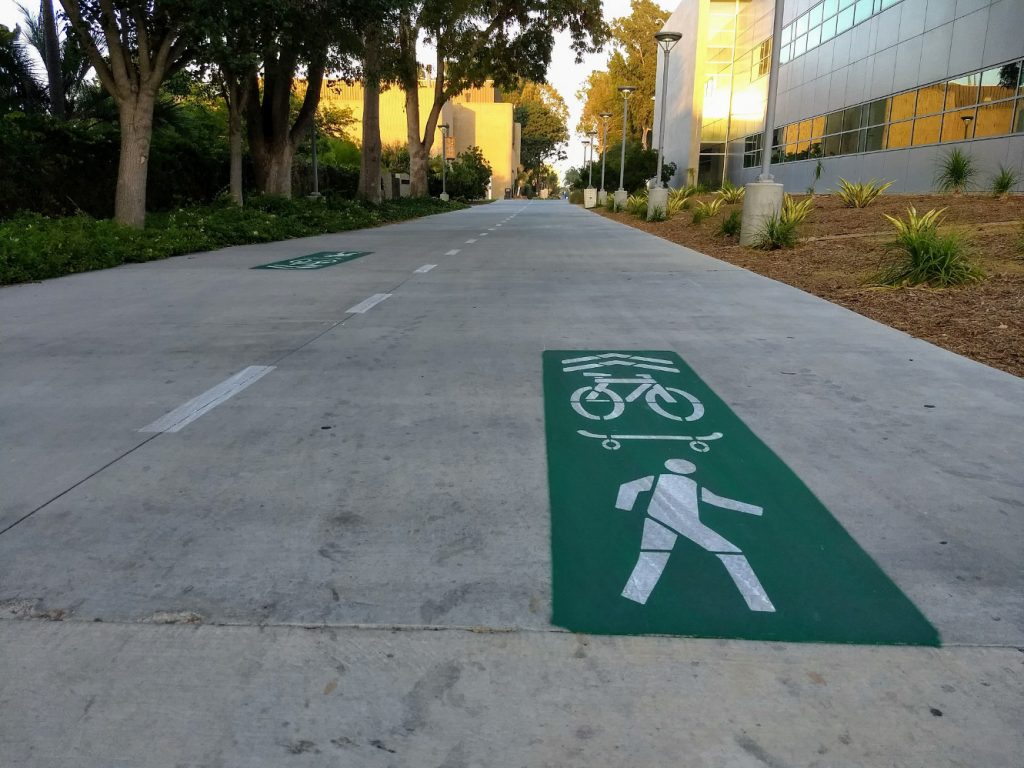
Bike path on campus
Near Biological Sciences and Horticulture.  The imagery of a bike, skateboard, and walker all in the same square is intended to show that this is a shared use pathway, with striping and arrows indicating directionality.

As part of this project, the campus will also be creating dismount zones, where users are asked to walk their wheels.  The largest of these is in the core of the campus (the region inside the loop), where pathways may be narrow, have pinch points, pass classroom doors, and/or have blind intersections that would be dangerous to ride through.

Redirecting people on bicycles and skateboards from narrow, unsafe pathways to the wide, well-marked loop should result in a much safer transportation experience for everyone at Orange Coast College.
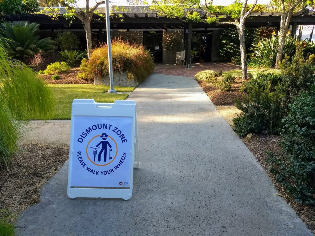
Sign with cute pirate and "please walk your wheels"
A dismount zone sign in the Horticulture Gardens seen during the April 2018 Wheeled Transportation Loop demonstration.

While this is a tremendous win for those of us who ride our bikes or skateboards (or kick scooters!) to/on campus, we need to be sure that we use this new loop wisely.  Just as paint can be applied, it can be removed or painted over, so please: ride responsibly on campus.
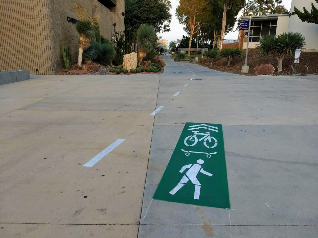
Bike Path on campus
Near Chemistry and Science Hall

And while you’re riding on campus, keep an eye out (and advocate!) for other improvements the campus is considering: mobility hubs (large bike / skateboard parking areas, complete with security cameras and seating), improved safety in parking lots (e.g., sharrows to mark routes through the lots, hopefully followed by wide shared-use pathways along the sides of the Adams and Merrimac lots), skateboard parking racks near buildings, and bike repair services.  If you’re interested in helping plan, find funding, and/or advocate for these changes on campus, drop me a line!
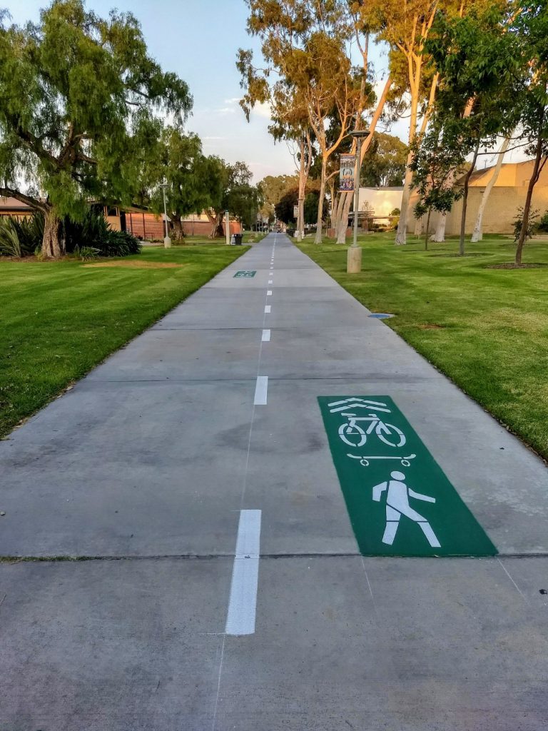
bike path on campus
Near the Arts Center.
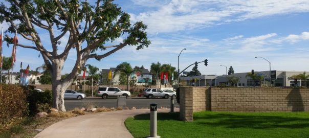
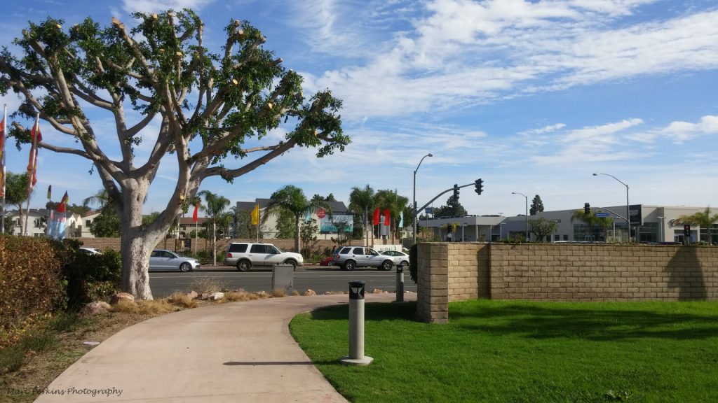
Harbor Blvd. entrance to the Tanager Drive Trail

Tanager Drive Trail extension update

[This is the fourth article in a series. The first article summarizes Costa Mesa’s draft active transportation plan, the second article discusses the proposed Tanager Drive Trail extension and Fairview Park multi-use trails, the third article discusses the plan’s implications for Orange Coast College, and the next article summarizes changes to the plan as it progressed through city committees. The plan was adopted by the City Council in June 2018.]

During the Bikeway and Walkability public outreach session on Wednesday December 6, Bill Burke, a resident of Tanager Drive, used his public comment time to address my post on the proposed Tanager Trail extension. Bill, and many of his neighbors, attended the meeting to speak in favor of the overall active transportation plan, but against putting an off-street multi-use trail behind their houses. After the meeting we were able to talk, and I met with him and Mike Chun the following Saturday to discuss active transportation in and around the Tanager Drive area.

The goal of this meeting was to give us an opportunity to share our personal views and experiences, and help us understand the issues better. I came out of the meeting with a much better understanding of their concerns, and a revised view of the situation.

Connections through the Upper Birds

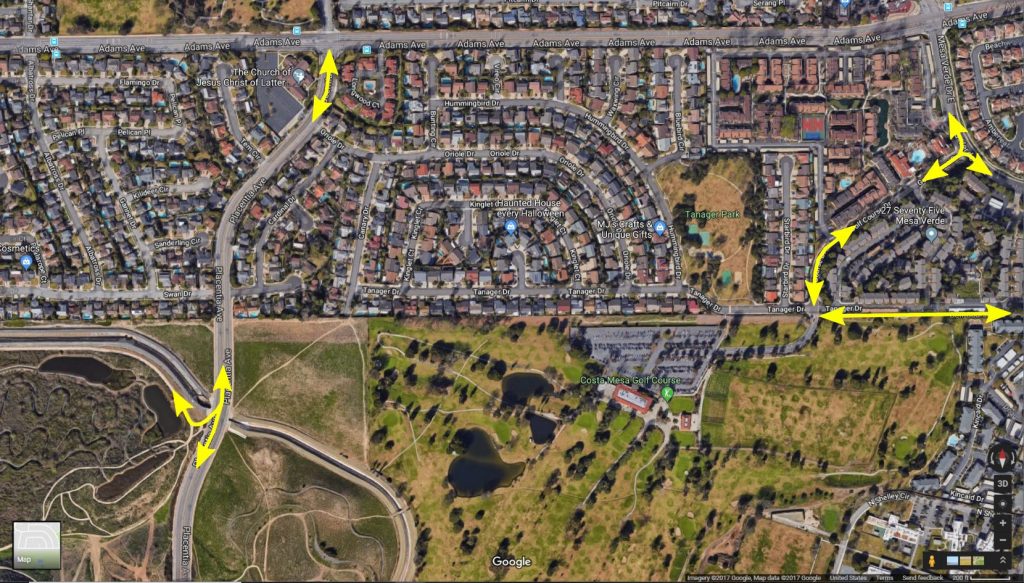
A starting point for discussing active transportation in this area of Costa Mesa is to look at all the connections that are served by the roads and trails in the Upper Birds neighborhood:

Marked up Google Map
A diagram illustrating the connections around the Upper Birds neighborhood in Costa Mesa. Map from Google Maps in December 2017.
  • Directly to the southwest is Fairview Park, a prime destination in the area as well as home to a very useful connection to the Santa Ana River Trail and Huntington Beach.
  • Also to the southwest is Placentia Avenue, which connects to homes, shopping, schools, and more.
  • To the northwest are homes in Mesa Verde, Estancia Park, Adams Avenue (which leads to Huntington Beach), and additional connections to the Santa Ana River Trail (at Gisler or Moon Park) for those traveling north.
  • To the southeast is the existing Tanager Drive Trail, which connects to the Harbor Village Apartments, Harbor Boulevard (for shopping and more), the homes in College Park, and Orange Coast College.
  • To the northeast, along Golf Course Drive and Mesa Verde East, are connections to shopping, additional residences (including the eastern part of Mesa Verde and the many apartments at 27 Seventy Five Mesa Verde), and another route to Orange Coast College.

Creating quality active transportation connections through this neighborhood will allow people traveling between all these points to do so more safely and easily. Students traveling between Orange Coast College and Huntington Beach, people heading to Fairview Park, folks heading to shopping near the Harbor and Adams intersection, commuters on their way to work, families out for a trip to the beach, and more could all use a connection in this region. But currently it’s not at all clear how to navigate the neighborhood (e.g., I had a student who lived in this neighborhood for more than a year but didn’t realize that the Tanager Drive Trail existed).

Off-street multi-use trail

A way to link all of those destinations in a clear, easy-to-navigate manner would be to create an off-street multi-use trail along the north side of the golf course, as discussed in this post.

Something I made clear when talking with Bill and Mike, and want to make clear here, is that while discussing a proposed extension of the Tanager Drive off-street multi-use trail I am not talking about building a “caged bike trail” that is a narrow strip of bumpy asphalt dominated by a looming chain-link fence. I would be opposed to building such a structure; fenced-in, narrow trails are, among other problems, unsightly (to both trail users and local residents) and unwelcoming to many potential trail users.

When I see plans to put a Class I trail on the north side of the golf course, I see a trail like the one just north of Castaways Park, or the San Diego Creek Trail, or the Harbor Cornerstone Trail: beautiful, wide, nicely lit, well-landscaped trails that are welcoming to all and are designed in such a way as to deter crime to the adjacent properties (e.g., by putting dense vegetation adjacent to property fence lines).

But what I envision may not be feasible in anything approaching the short term. Continue reading Tanager Drive Trail extension update

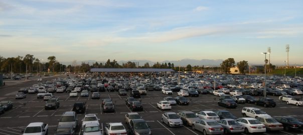
The Adams Parking Lot of Orange Coast College.

Costa Mesa’s draft Active Transportation Plan: Benefits for OCC

[This is the third article in a series. The first article summarizes Costa Mesa’s draft active transportation plan, the second article discusses the proposed Tanager Drive Trail extension and Fairview Park multi-use trails, the next article is an update on the Tanager Drive Trail extension, and the fifth article summarizes changes to the plan as it progressed through city committees. The plan was adopted by the City Council in June 2018.]

I’ve taught at Orange Coast College for fifteen years, and for all of those years I’ve lived within walking and biking distance of the campus. Being able to bike or walk to work every morning has been a tremendous asset in my life; instead of sitting in traffic fuming, I get to start every day with a short ride or walk through the pleasant Costa Mesa weather, possibly stopping in a park to enjoy my tea if I’ve got a bit of extra time. I’m happier, healthier, and fitter (and a better teacher) thanks to biking and walking to work.

Existing active transportation facilities near Orange Coast College

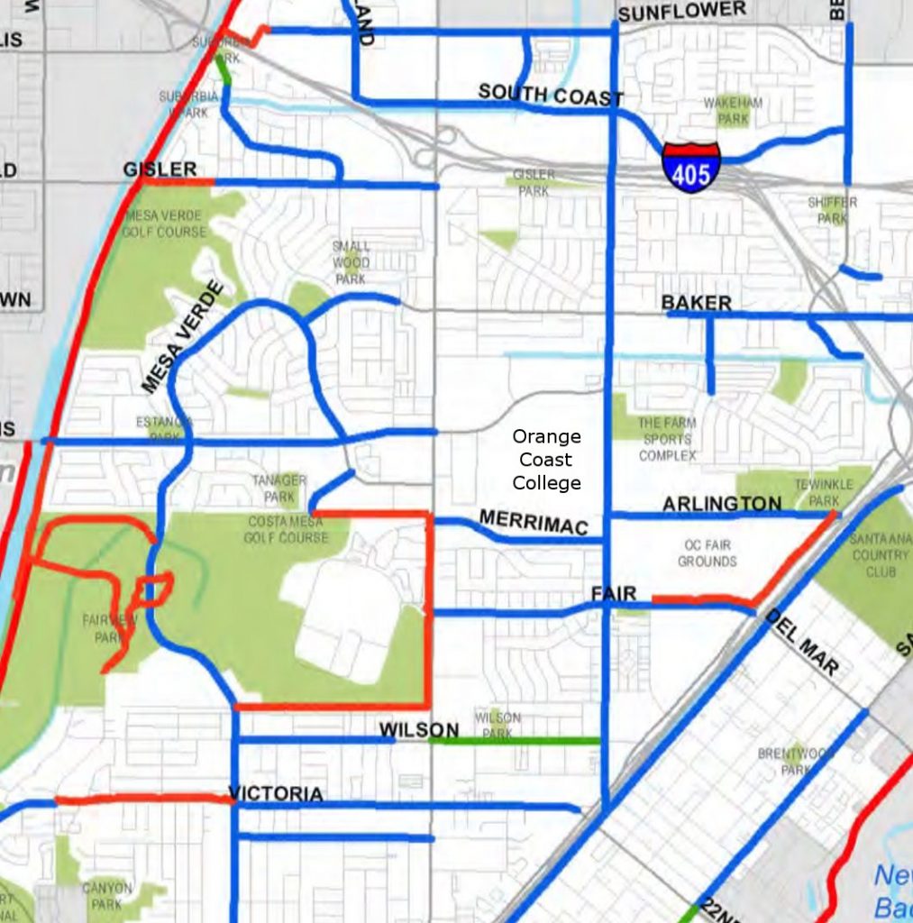
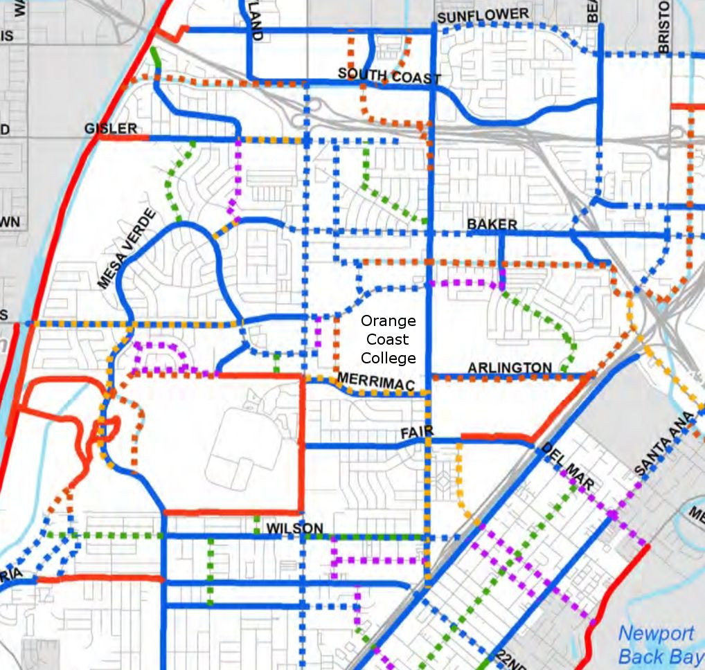
But actually getting to OCC by biking or walking right now is … not trivial. The city’s existing active transportation infrastructure has significant gaps around the campus – take a look at how few connections there are to OCC with the current infrastructure (especially from the north):

Map of facilities around OCC.
The existing active transportation facilities around Orange Coast College, as seen in the August 2017 draft of the Costa Mesa Active Transportation Plan. Red lines are off-street multi-use trails, blue lines are bike lanes, and green lines are bike routes.

Proposed new facilities near Orange Coast College

The most recent draft active transportation plan the city has posted online includes many proposals that are relevant to Orange Coast College:

Existing and proposed bike facilities around OCC
The proposed active transportation facilities around Orange Coast College, as seen in the August 2017 draft of the Costa Mesa Active Transportation Plan. Red lines are off-street multi-use trails, blue lines are bike lanes, yellow lines are protected bikeways, green lines are bike routes, and purple lines are bicycle boulevards. Solid lines are existing facilities, dashed lines are proposed new facilities.

[Note: For more background on the difference between off-street multi-use trails, bike lanes, protected bikeways, bike routes, and bicycle boulevards, see my summary post on the draft Active Transportation Plan.]

There are many improvements relevant to OCC, which I’ll cover by general location. Continue reading Costa Mesa’s draft Active Transportation Plan: Benefits for OCC

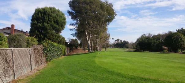
Proposed trail location on the north edge of the golf course.

An examination of the proposals around Tanager Drive in Costa Mesa’s draft Active Transportation Plan

[This is the second article in a series. The previous article summarizes Costa Mesa’s draft active transportation plan, the next article discusses the plan’s implications for Orange Coast College, the fourth article is an update on the Tanager Drive Trail extension, and the fifth article summarizes changes to the plan as it progressed through city committees. The plan was adopted by the City Council in June 2018.]

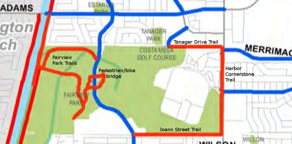
In this article I will discuss the current state of active transportation (walking, bicycling, jogging, etc.) infrastructure on the northern side of the Costa Mesa Golf Course and Fairview Park, and then go over the proposals included in the city’s draft active transportation plan.

To jump straight to the discussion of the proposals, click here

Existing facilities in the region

map of costa mesa bike facilities
The existing active transportation facilities around Fairview Park, as seen in the August 2017 draft of the Costa Mesa Active Transportation Plan. Red lines are off-street multi-use trails; blue lines are bike lanes

The current facilities in the region include:

  • The Tanager Drive off-street multi-use trail
  • The Fairview Park off-street multi-use trails

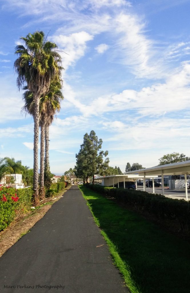
Existing Tanager Drive Trail

Tanager Drive Trail
Existing Tanager Drive Trail

The Tanager Drive Trail is an off-street multi-use trail leading from Harbor Boulevard to Golf Course Drive. The trail runs along the northern border of the Harbor Village apartments and the northeastern border of the Costa Mesa Golf Course. The trail was recently repaved, and is frequently used by local residents (including yours truly, who bikes to work on it most days).

Harbor Blvd. entrance to the Tanager Drive Trail

The Tanager Drive Trail connects with the Harbor Cornerstone Trail, which connects to the Joann Street Trail, allowing people to easily access the Tanager Drive Trail from multiple areas of Harbor Boulevard.

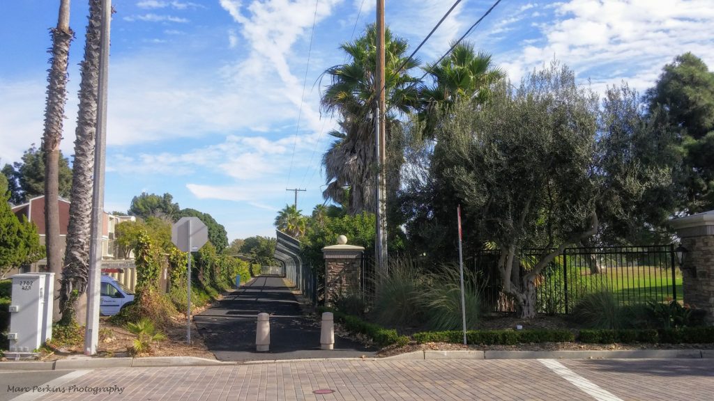
Eastern entrance to the Tanager Drive Trail

The end of the Tanager Drive Trail at Golf Course Drive is not well-marked, leading many people to be unaware that there is a multi-use trail open to the public at that location. The lack of good marking also makes it a dangerous location to enter the trail; I’ve almost been hit there on my bike by vehicles exiting the golf course. Continue reading An examination of the proposals around Tanager Drive in Costa Mesa’s draft Active Transportation Plan

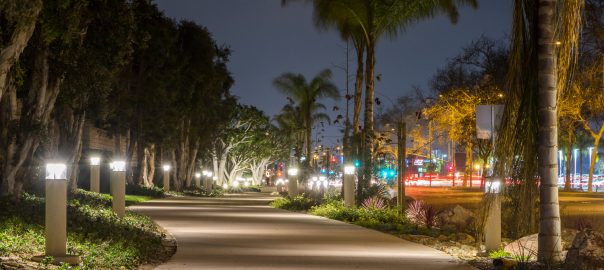
Harbor Blvd. Bike Trail at night

Costa Mesa’s draft Active Transportation Plan: A summary

Cover of the 2017 transportation plan.[This is the first article in a series on Costa Mesa’s draft Active Transportation Plan.  The next article discusses the proposed Tanager Drive Trail extension and Fairview Park multi-use trails, the third article discusses the plan’s implications for Orange Coast College, the fourth article is an update on the Tanager Drive Trail extension, and the fifth article summarizes changes to the plan as it progressed through city committees.  The plan was adopted by the City Council in June 2018. ]
The city of Costa Mesa is working on a new active transportation plan. The plan is being drafted by Stantec, with input from city residents, city staff, and the city’s Bikeway and Walkability committee. The most recent version of the plan available online is the August 2017 draft.

The Bikeway and Walkability Committee is currently soliciting public input on the plan, with the second of two public outreach sessions happening Wednesday, December 6, 2017 at 7:00pm in conference room 1A at Costa Mesa City Hall.

To help people understand this new plan, which is more than 75 pages long, I’ll try to summarize some of the key elements in this post.

Existing infrastructure

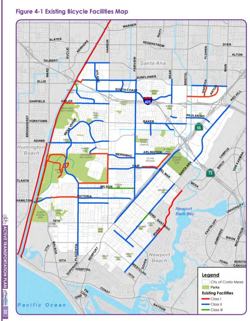
The city currently has 43.5 miles of bike routes, though only nine of those are Class I (off-street) bicycle paths that completely separate cyclists from traffic; most of the rest are bike lanes painted on the edge of roadways.

A map of Costa Mesa, CA showing bike paths.
Map of Costa Mesa’s existing bike facilities, from the August 2017 draft of the Costa Mesa Active Transportation Plan. Red lines are Class I (off-street multi-use trails), blue lines are Class II (bike lanes), and green lines are Class III (bike routes).

Types of bicycle paths

Here’s what the colored lines on that map mean:

Class I: off-street multi-use trail

Person on bike on Class I bike path.
A person on a bike rides along the Harbor Cornerstone Bike Trail in Costa Mesa.

Indicated on the map with red lines, these are pathways that completely separate the people on them from motor vehicle traffic. These are by far the most welcoming to people of all ages and all skill levels, such as children, inexperienced bicyclists, or people with disabilities. Class I trails are not just for cyclists: dog walkers, roller skaters, joggers, kids on scooters, and everyone else can use them too.

The shining star of Class I bicycle paths in Costa Mesa is the Harbor Boulevard Cornerstone Trail, built in 2016, that runs along Harbor between Merrimac and Fair.

Some of the best cycling/walking/recreational areas in the county are anchored by Class I trails: Newport Back Bay, the San Diego Creek Trail, Castaways Park, and more.

Bike trail on cliffs above water.
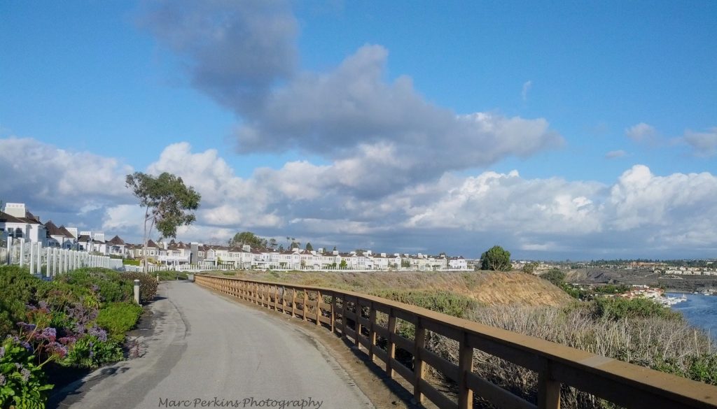
The trail that leads north out of Castaways Park heads along the cliffs above Newport Back Bay and behind some gorgeous homes. It’s a beautiful example of a Class I trail.
lights illuminate the fog-shrouded bike trail.
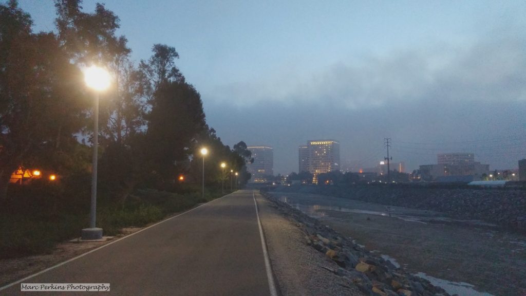
A foggy evening on the San Diego Creek Trail in Irvine.

Class II: bike lanes

Continue reading Costa Mesa’s draft Active Transportation Plan: A summary

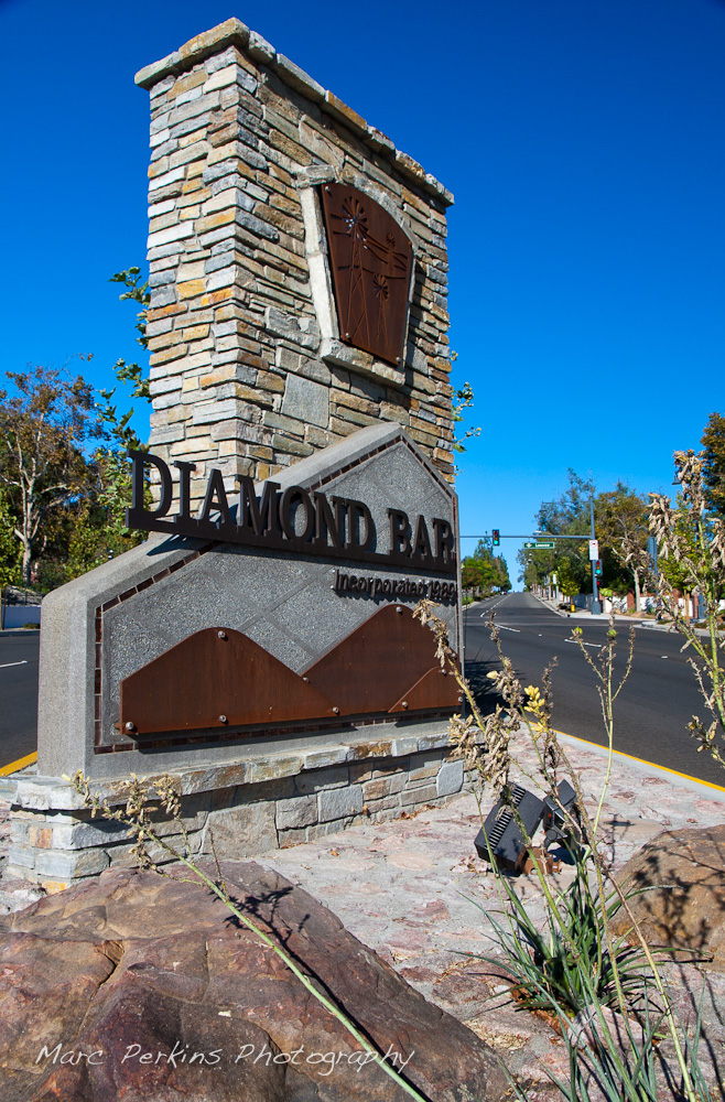
Two intersections in Diamond Bar: The Grand Avenue Beautification Project

In 2015 the city of Diamond Bar completed their Grand Avenue Beautification project, which included redesigning the medians and parkways of the Grand Avenue / Diamond Bar Boulevard and Grand Avenue / Longview Drive intersections. The landscape architecture work was done by David Volz Design.

Happily enough, Diamond Bar Boulevard aims directly at Mt. Baldy, creating a view no photographer can resist*:

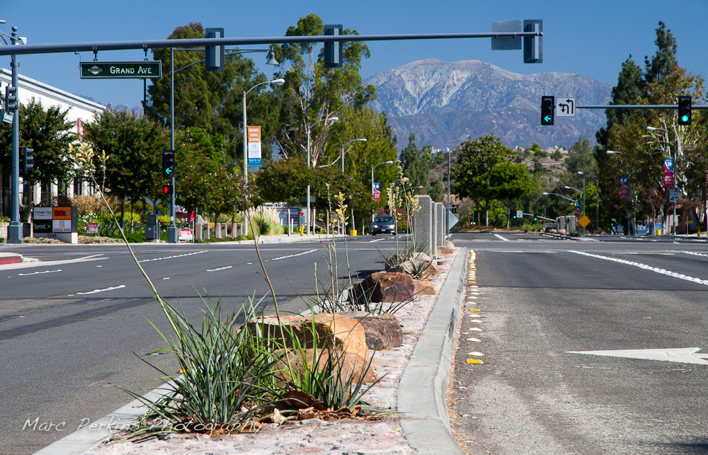
Mt. Baldy (Mount San Antonio) seen from the southern side of the Diamond Bar Boulevard and Grand Avenue intersection in Diamond Bar. Rocks, median art, and flowering plants (yellow yuccas - Hesperaloe parviflora) are all visible, including a car. The stoplight is showing all green lights and a green left turn signal. This was part of the 2015 rebuild of the Grand Avenue and Diamond Bar Boulevard intersection for Diamond Bar's 2015 "Grand Avenue Beautification" project, landscape architecture for the project was by David Volz Design.
Mt. Baldy (Mount San Antonio) seen from the southern side of the Diamond Bar Boulevard and Grand Avenue intersection in Diamond Bar.

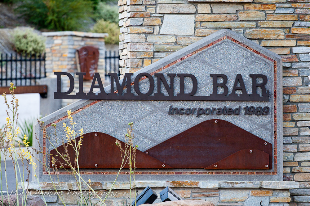
The Longview Drive intersection is at the eastern edge of the city, and features a new entrance sign for the city:

A full view near sunrise of the sign at the eatern edge of Diamond Bar's Grand Ave. This was part of the 2015 rebuild of the Grand Avenue and Longview Drive intersection for Diamond Bar's 2015 "Grand Avenue Beautification" project, landscape architecture for the project was by David Volz Design.
A full view of the sign at the eastern edge of Diamond Bar’s Grand Ave.

The sign is pretty just after sunrise, but the copper elements really stand out when it’s diffusely lit:

The entrance sign to Diamond Bar on the eastern edge of the city. This image, taken in the shade, highlights the coppery accents of the sign. This was part of the 2015 rebuild of the Grand Avenue and Longview Drive intersection for Diamond Bar's 2015 "Grand Avenue Beautification" project, landscape architecture for the project was by David Volz Design.
The entrance sign to Diamond Bar on the eastern edge of the city.

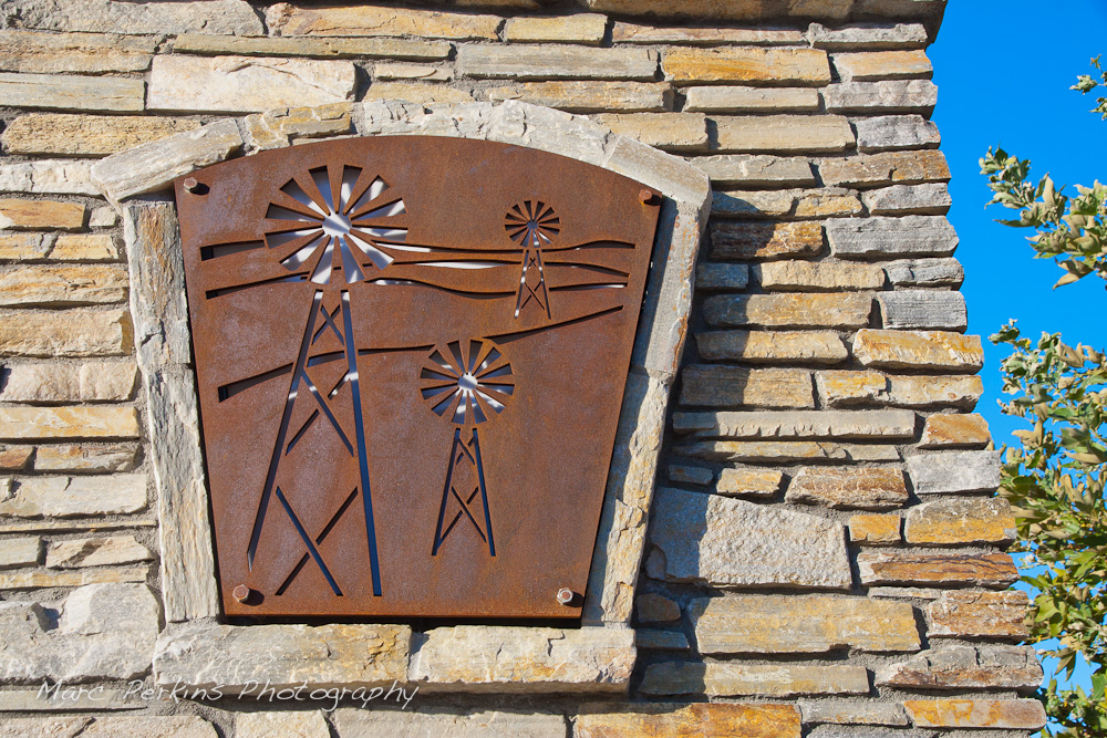
Iron plates form a repeating theme through the project, serving not just as elements on the entrance sign, but also as artistic inserts on parkway columns, display pieces in medians, and tree grates.

Metallic cutouts with a windmill pattern are frequent in the Grand Ave. corridor; this one is on the large entrance sign on the eastern edge of the city. This was part of the 2015 rebuild of the Grand Avenue and Longview Drive intersection for Diamond Bar's 2015 "Grand Avenue Beautification" project, landscape architecture for the project was by David Volz Design.
Metallic cutouts with a windmill pattern are frequent in the Grand Ave. corridor; this one is on the large entrance sign on the eastern edge of the city.

Continue reading Two intersections in Diamond Bar: The Grand Avenue Beautification Project

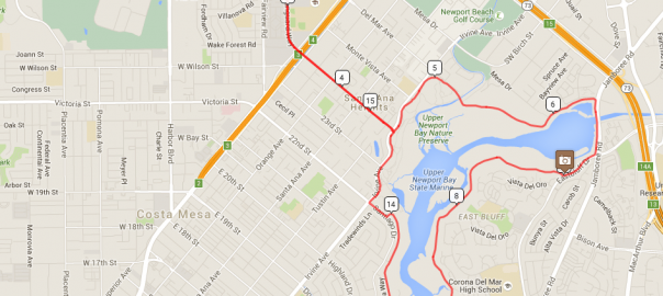
Map for my Costa Mesa to Newport Back Bay loop. Map data from Google 2016; ride details from RideWithGPS.

Ride: Newport Back Bay loop from Costa Mesa

Introduction

Newport Back Bay seen from Castaways Park.

Newport Back Bay is a gem of central Orange County.   It’s a wetlands estuary located just inland from Newport Harbor, and has roughly six miles of paved bike path that allow you to ride only feet away from nature.  The views can be gorgeous, and I’ve seen many stunning sunsets while riding it.

For years I suggested that my students do an outdoor project at Newport Back Bay, and many came back saying “I never knew this was there; I loved it!”

However, actually cycling around Newport Back Bay is more complicated than it should be because the bicycle path does not actually form a complete loop around the bay.  On the eastern side the bike trail ends about a quarter mile north of PCH, and then doesn’t truly start up again until about a mile and a half north of PCH on the western side.  Thus, riders wanting to do a true loop must fend for themselves and figure out how to get through PCH and city streets to get back to the trail.

Route

I’ve created a complete loop with detailed notes in RideWithGPS: Costa Mesa -> Newport Back Bay Loop, and embedded a live view of the route below.  When starting from Estancia Park in Costa Mesa the route is just about 19 miles round trip and gains a total of 450 feet of elevation. Continue reading Ride: Newport Back Bay loop from Costa Mesa

A portion of Newport Beach's skyline at night

Newport Beach at Night

Lately I’ve started bicycling longer distances1, and as I’m riding, I’m seeing more of my local area. So many of the bicycle paths lead to stunning views, not to mention the gorgeous little parks.

But now that it’s winter I’m out riding a lot at night. Night changes so much about the landscape, especially in urban areas where a single bright point-source of light (the sun or moon) is replaced by multiple small light sources, many of which are different colors and intensities. Combine the change in illumination with a requirement for long exposure times and you have a recipe for a dramatic visual change.

I wanted to try to capture some of that changed beauty, so I recently biked to a couple of my favorite vantage points in Newport Beach to try my hand at it.

A moonlit view of Lower Newport Bay (and partially Upper Newport Bay) with PCH (Pacific Coast Highway) to the right and Newport Center's many tall buildings that surround Fashion Island in Newport Beach, CA.  Saddleback Mountain (Santiago Peak and Modjeska Peak) can be seen off in the distance, to the left.  This image is a minimally manipulated single-frame, long-exposure capture. (Marc Perkins/Marc Perkins Photography)
A moonlit view of Newport Beach’s Lower Newport Bay (and partially Upper Newport Bay) with PCH (Pacific Coast Highway) to the right and Newport Center's many tall buildings that surround Fashion Island to the left. Saddleback Mountain can be seen off in the distance, to the left.
The view of west Newport Beach as seen from Ensign View Park (on Newport Heights).  Visible to the left is the Lido Peninsula and western tip of Lido Island with the Via Lido Bridge.  Pacific Coast Highway (PCH) is visible in the foreground, as are many of the buildings on the Balboa Peninsula's western portion.  The two tall buildings on the left are the  the Vista Del Lido complex and the 601 Lido Condominiums; the two tall buildings on the right (that almost appear as one) are Newport: The Towers (3121 PCH) and Newport Surgery Center (3333 PCH).  This image is a minimally manipulated single-frame, long-exposure capture. (Marc Perkins/Marc Perkins Photography)
West Newport Beach as seen from Ensign View Park (in Newport Heights). Visible to the left is the Lido Peninsula and western tip of Lido Island with the Via Lido Bridge; Pacific Coast Highway (PCH) is visible in the foreground, as are many of the buildings on the Newport Peninsula's / Balboa Peninsula's western portions. 2

But those are just general overviews; the image I’m happiest with takes just a piece of one of those and lets your eye linger on the details:

A view of west Newport Beach's Newport Harbor as seen at night from Ensign View Park.  In the foreground are buildings surrounding the Pacific Coast Highway (PCH); the back of the 2436 Pacific Coast Highway office building (that looks like a motel) is prominent, as is the Bayport Yachts round turret and Joe's Crab Shack.  Behind that are buildings on Newport Peninsula / Balboa Peninsula that front Newport Harbor, most striking among them is the multi-story Blackman Ltd. building at 3388 Via Lido Drive, with the parking structure at the Lido Marina Village on the right.  Behind those buildings and the palm trees lie two open-ocean oil platforms (one above the Blackman building, and one above the parking structure), which almost look as if they're floating in space.  This image is a minimally manipulated single-frame, long-exposure capture. (Marc Perkins/Marc Perkins Photography)
A closer look at a portion of west Newport Beach's Newport Harbor as seen at night from Ensign View Park. Pacific Coast Highway (PCH) is in the foreground; behind that are buildings on Newport Peninsula / Balboa Peninsula that front Newport Harbor, most striking among them is the multi-story Blackman Ltd. building at 3388 Via Lido Drive, with the parking structure at the Lido Marina Village on the right. Behind those and the palm trees lie two open-ocean oil platforms (one above the Blackman building, and one above the parking structure).

All of these are single-frame exposures with minimal manipulation in post processing. A few more images can be found in my Newport Beach at Night album.

1 I’m trying to get in at least 80 miles a week, and am hoping to build up to riding a century in a few months.
2 The two tall buildings on the left are the Vista Del Lido complex and the 601 Lido Condominiums; the two tall buildings on the right (that almost appear as one) are Newport: The Towers (3121 PCH) and Newport Surgery Center (3333 PCH).

How to convert a child bike trailer into a cargo trailer: an illustrated guide

I’ve been trying to do more of my errands by bicycling, and one of my biggest holdups has been a lack of cargo room: it’s hard to lug home 80 pounds of cat litter in a backpack. So, a few months ago I started shopping on Craigslist for a bike trailer, only to find out that a good friend had one in her garage that I could have for free.

My Schwinn Spirit bike trailer before modifying it to had a wooden platform to carry cargo. (Marc C. Perkins)
My Schwinn Spirit bike trailer before modification.

That’s a Schwinn (Pacific Cycle) Spirit Bicycle Trailer, rated to hold up to two 50-lb kids (aka: 100 pounds of cargo!). I immediately fell in love with it, and even used it to lug home 80 pounds of cat litter from the pet store:

Two 42-pound bags of Fresh Step cat litter strapped in like kids into my bike trailer's child harness.  So cute! (Marc C. Perkins)
Two 42-pound bags of Fresh Step cat litter strapped in like kids into my bike trailer's child harness. So cute!

An unexpected bonus of the trailer is that whenever I have it attached to my bike, cars give me more maneuvering room. I bike on city streets in Orange County, CA, and am used to having only a few inches of space between my side mirror and the cars zipping past me. But when I’m using the trailer, most cars will actually change lanes before even attempting to pass me (or at least give me four or five feet of clearance), and I’ve had multiple people literally stop to let me go in front of them. Amazing.

But using the trailer for cargo has proved to be less than ideal, as the bottom of the trailer is just made of soft fabric: the kids’ weight is designed to be supported entirely by the harness (which is hung from a horizontal metal rod). So, unless I had cargo that was perfectly sized to fit into that harness (like the bags of cat litter), I was limited to low weight.

The Schwinn Spirit bike trailer has a lot of flat, open room in it once the child harness has been removed. (Marc C. Perkins)
The bottom of the Schwinn Spirit bike trailer (with the child harness removed) is just thin fabric: not good for cargo.

So, I wanted to modify the trailer to add a solid base to convert it to a cargo trailer, and while I found lots of DIY tutorials, they all involved removing the fabric. However, I wanted to keep the fabric on my trailer to protect my cargo from weather and prevent it from blowing around. Additionally, my guess is that the extra space I’m getting when I use the trailer is due to both the visual bulk of the trailer (it’s actually the same width as my handlebars, but makes my bike look much wider) and also because people think there are cute wittle children in the trailer and thus are panicked about the possibility of hitting them1.

So, what I ended up doing is removing the harness and adding a wooden shelf that fit inside the existing fabric, so my trailer now looks like this:

A view of my DIY bike trailer modification from the front looking in.  The shelf is high enough that it doesn't hit the fabric on the bottom of the trailer, but low enough to hold a large amount of stuff.  As a bonus, the shelf is hard to see, so drivers don't know there's not a kid inside :) (Marc Perkins)
My finished cargo trailer!

Read on for full instructions on how I built this!

Materials

Continue reading How to convert a child bike trailer into a cargo trailer: an illustrated guide

First tomatoes of the year: a lighting comparison

Michelle and I tend our backyard garden every summer, and one of our joys is seeing the first produce of the year slowly ripen on the plants. Just this week our first cherry tomatoes (Solanum lycopersicum) are finally ripening, and so yesterday I took a few pictures of the glorious first fruits:

The first fruit of the year in our garden: two deliciously orange cherry tomatoes still "on the vine" (attached to the plant).  This plant is a "sun sugar" variety of tomato (Solanum lycopersicum) that we purchased from Orange Coast College's ornamental horticulture department.  This picture was taken in the field using natural lighting to create an in-vivo look. (Marc C. Perkins)
Two ripe Sun Sugar cherry tomatoes still attached to the plant, photographed using natural light only.

The tomatoes were in some nice diffusely-lit shade, and that’s what you see above – I used a tripod to stabilize the camera, but otherwise didn’t need anything else.

But since I’ve been having fun experimenting with off camera lighting recently, I decided to pull out my lighting gear and try some “studio” style lighting on the fruits.

The first fruit of the year in our garden: two deliciously orange cherry tomatoes still "on the vine" (attached to the plant).  This plant is a "sun sugar" variety of tomato (Solanum lycopersicum) that we purchased from Orange Coast College's ornamental horticulture department.  This picture was taken in the field using studio lighting (off camera flashes) to create a more dramatic look. (Marc C. Perkins)
The same two ripe Sun Sugar cherry tomatoes, photographed using “studio” lighting.

Those are the exact same fruits in the exact same position, but now they’ve been lit using the “invisible black background” technique I’ve described before1.

What a difference lighting makes! The black background makes the fruits pop out visually, thanks to less visual clutter, but I think it also makes the scene look more artificial (or as though it was taken at night). My favorite comment so far comes from my dad, who said that the fruit look like two “hot Jupiters”. Little tomato planets floating in space; I like it.

Footnotes

1 Two snooted flashes were setup, one on either side of the fruit, and I used my gray card to shade the background from the primary flash’s illumination. Both flashes also had great natural gobos: the branches of the plant itself.

More pictures

To see more of my plant-related pictures, head to my Botany and Mycology gallery collection.