[This is the fifth article in a series. The first article summarizes Costa Mesa’s draft active transportation plan, the second article discusses the proposed Tanager Drive Trail extension and Fairview Park multi-use trails, the third article discusses the plan’s implications for Orange Coast College, and the fourth article is an update on the Tanager Drive Trail extension. The plan was adopted by the City Council in June 2018.]
Costa Mesa’s draft Active Transportation Plan heads to the City Council this Tuesday (June 5) for consideration, after having been recommended for adoption by the City’s Planning Commission at their May 14 meeting.
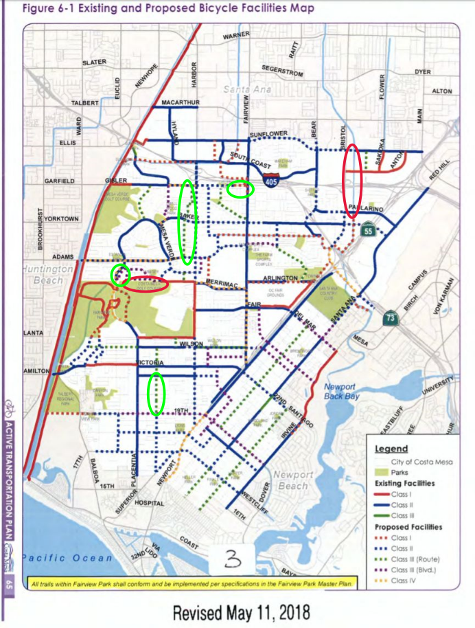
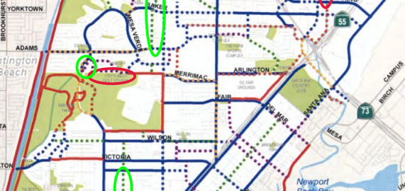
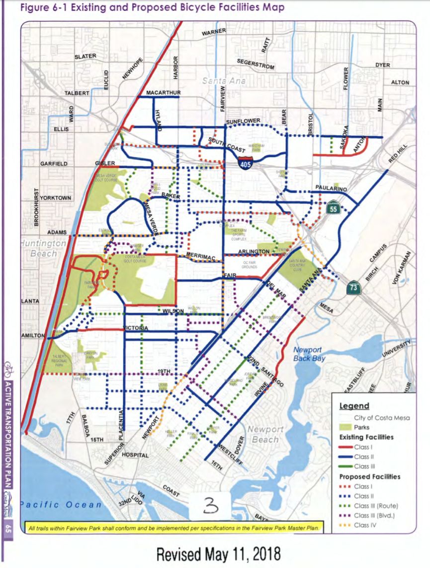
The active transportation plan, as approved by the Planning Commission, has had a few changes since I last summarized it back in December (using information from the August 2017 draft):
1) The Tanager Drive Trail Extension, which would have run behind houses along Tanager Drive on the northern edge of the Costa Mesa Golf Course, has been removed from the plan. Additional Class III Bike Boulevards on the neighborhood streets nearby have been added (along Cardinal Drive and Swan Circle), essentially in line with Bill Burke’s, Mike Chun’s, and my joint letter. This change was approved by the city’s Bikeway and Walkability Committee at their April 4 meeting, apparently after the city had received additional feedback from local residents against the proposed trail extension.
2) The The Airport Channel / Delhi Channel Class I Off-Street Multi-Use Trail, which would have created a bicycle and pedestrian crossing of the 405 in the northeastern portion of the city, has been removed from the map but left in the text of the plan. I hope that this facility is able to remain a portion of the plan, as even though a Class I off-street multi-use trail in the area and bridge over the 405 would clearly be expensive and difficult to build, a safe crossing of the 405 in that area of Costa Mesa would dramatically improve active transportation in the region (just as the Santa Ana River Trail’s safe undercrossing of the 405 in western Costa Mesa has done for that side of the city).
3) The August draft left a gap in bike infrastructure along Pomona Avenue between Hamilton and 19th; in the revised plan this has been filled by the addition of a Class III bike route on the street. Given that this is the very area where a driver nearly hit a group of OCC bicyclists a few weeks ago, this is a needed change.
4) A Class III bike route was added to the streets (Royal Palm, Mace, Caraway, and Cinnamon) just west of Harbor Boulevard between Gisler and Adams, with the goal of providing cyclists an alternate to southbound Harbor Boulevard in that region of Costa Mesa. Nicknamed by some the “In-N-Out Trail,” this will allow cyclists to travel all the way from In-N-Out (Gisler and Harbor) nearly to Wilson on safer side streets, avoiding two miles of busy Harbor Boulevard without adding much distance (less than three-quarters of a mile extra travel).
5) The eastern edge of Gisler has had a Class I off-street multi-use trail connection to Fairview added, which will make Gisler a much more useful street for cyclists. Given that there is already a paved walking path already in existence in this area, this doesn’t seem like much of a change.
6) A notation has been added that “All trails within Fairview Park shall conform and be implemented per specification in the Fairview Park Master Plan.”
Here’s a marked-up map showing the location of the changes: