When I got my road bike last July I discovered that I loved to take it on 20 or 30 mile rides, and started dreaming of going further. So, I asked around about good first centuries to aim for, and one event kept getting mentioned again and again: Tour de Palm Springs (with Cool Breeze in Ventura also getting many votes).
The timing was perfect – Tour de Palm Springs happens every year in January or February, so that gave me months to train up. I followed a training plan from Burke and Pavelka’s The Complete Book of Long-Distance Cycling, which helped me slowly increase my cycling distances from ~50 miles a week about 3 months ago to 150 miles a week in the two weeks before the century*.
One of the reasons I love cycling is that it gets me out, exploring the environment and seeing sights I otherwise would have missed. Today was a great example of that.
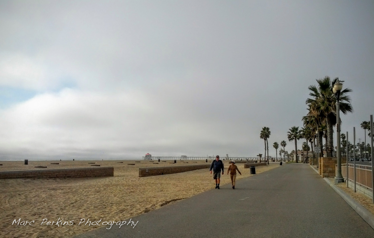
I was on one of my usual loops up Huntington Beach and then down around Newport Back Bay; the weather seemed like nothing special (you know, it’s January and 70F outside).
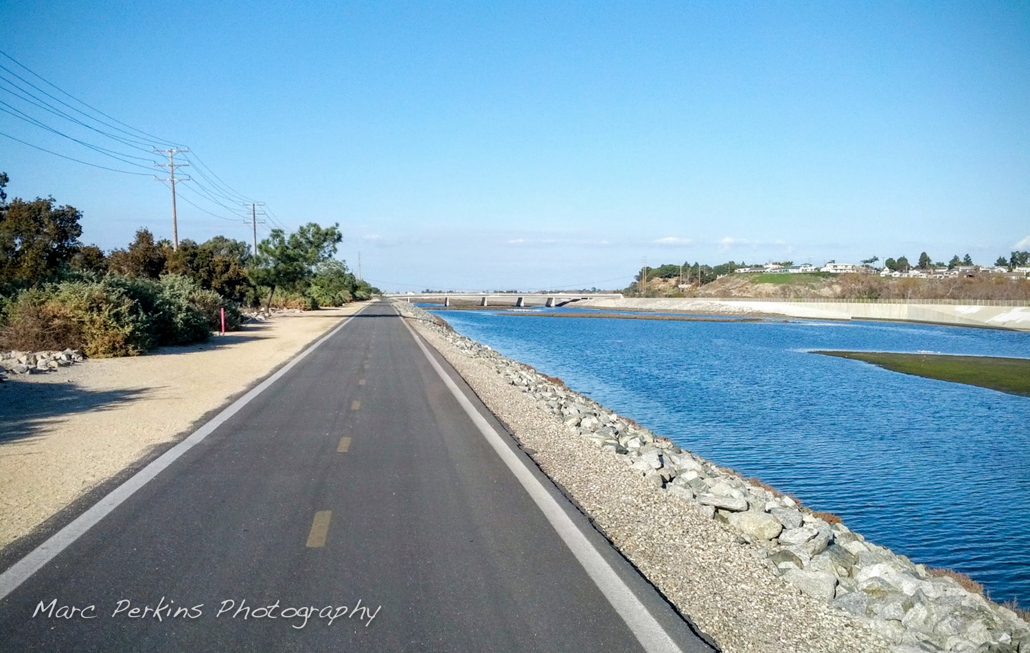
As is usual of mid-week rides this time of year, the Huntington State Beach trail was nearly empty:
You can zip along the Huntington State Beach Trail midweek – whee!
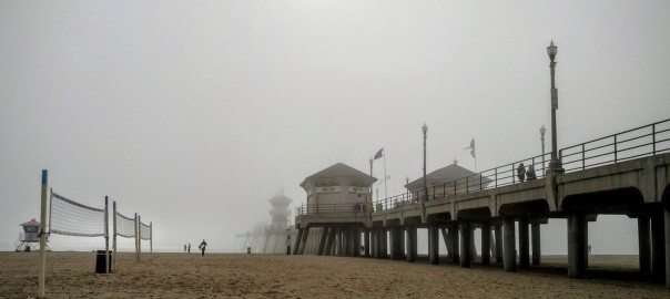
I rode past the pier, and paused to enjoy the view and snap a couple pictures with the sun barely visible through the clouds:
Huntington Beach Pier, when I first arrived.
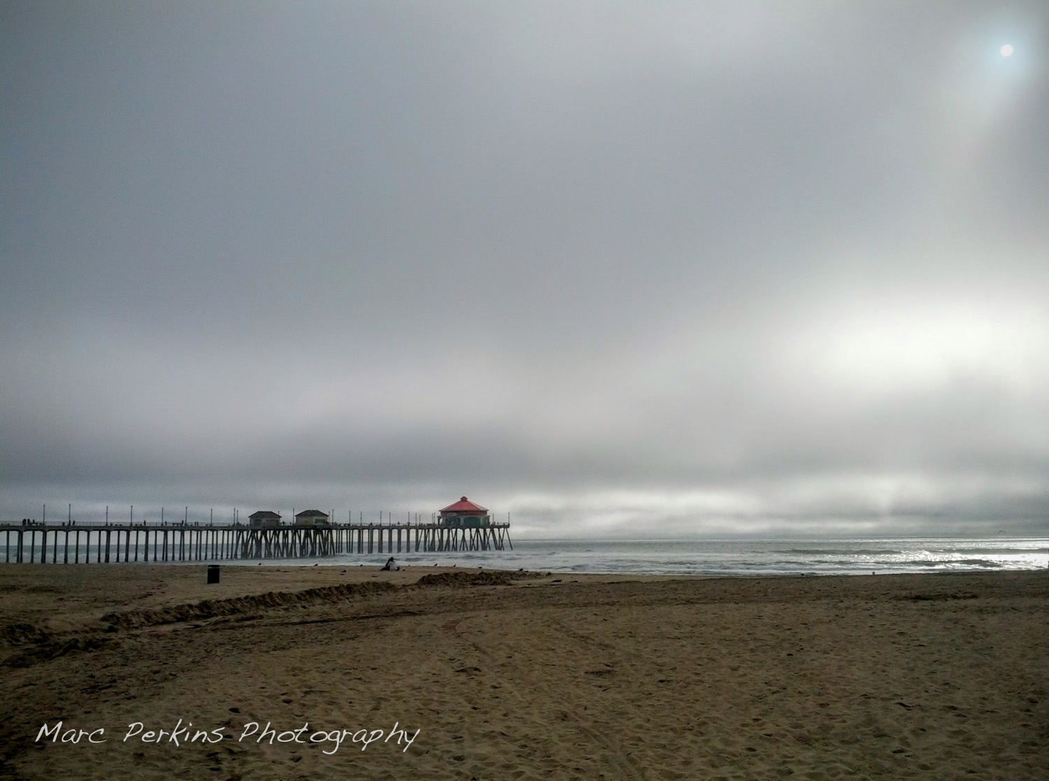
I went just a bit further on up the trail, then realized that the white blur in the distance and cold breeze I was feeling meant that fog was rolling in. I turned around, and the pier was nearly gone: Continue reading Sights: Fog at the Huntington Beach Pier→
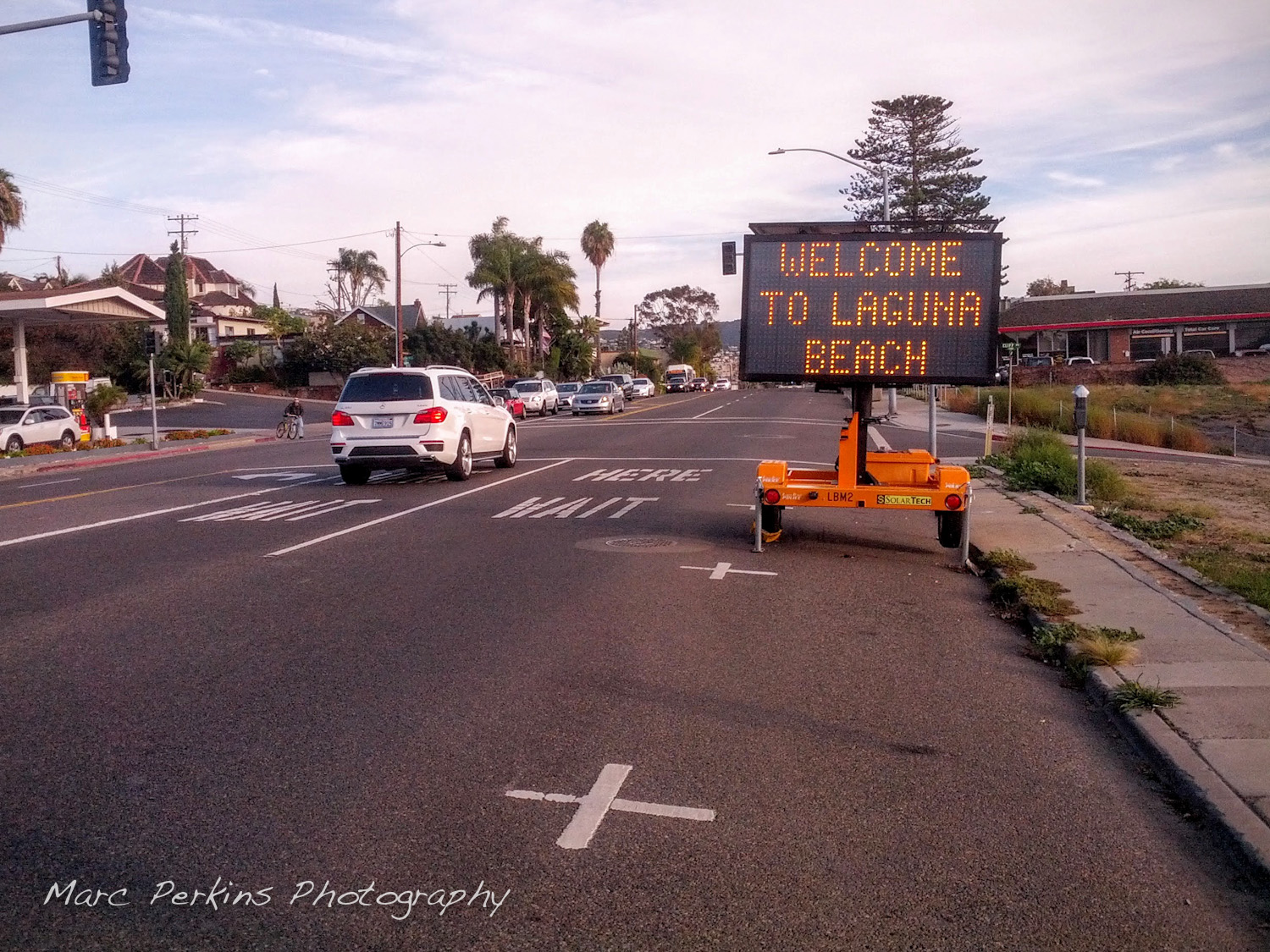
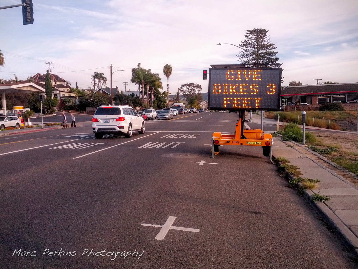
Okay, the headline might be a bit exaggerated, but when I come across a sign like this in a city, my heart goes pitter-pat:
Welcome to Laguna BeachGive Bikes 3 Feet
Thanks Laguna Beach!
And in case you don’t know what the sign is referring to, it’s referring to California’s 2014 “Three Feet For Safety Act” (AB-1371), which mandates that
21760. (b) The driver of a motor vehicle overtaking and passing a bicycle that is proceeding in the same direction on a highway shall pass in compliance with the requirements of this article applicable to overtaking and passing a vehicle, and shall do so at a safe distance that does not interfere with the safe operation of the overtaken bicycle, having due regard for the size and speed of the motor vehicle and the bicycle, traffic conditions, weather, visibility, and the surface and width of the highway.
(c) A driver of a motor vehicle shall not overtake or pass a bicycle proceeding in the same direction on a highway at a distance of less than three feet between any part of the motor vehicle and any part of the bicycle or its operator.
(d) If the driver of a motor vehicle is unable to comply with subdivision (c), due to traffic or roadway conditions, the driver shall slow to a speed that is reasonable and prudent, and may pass only when doing so would not endanger the safety of the operator of the bicycle, taking into account the size and speed of the motor vehicle and bicycle, traffic conditions, weather, visibility, and surface and width of the highway.
So, basically, cars must give bicyclists at least three feet of space when passing them, or slow to a reasonable speed and pass without risking injury to the cyclist. Given the frequency with which cyclists need to dodge debris (and just plain lose their balance), a three foot passing margin is really a good idea.
Of course it’d be nice if police actually wrote tickets for violations of this law … but hey, I’ll take a sign as a good start.
Seen on December 24, 2015 as I enjoyed a lovely ride down PCH.
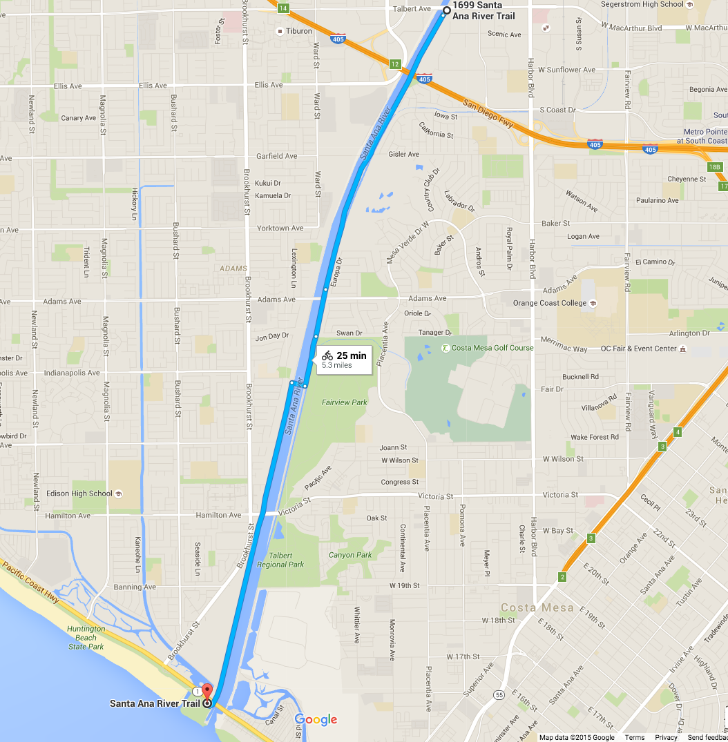
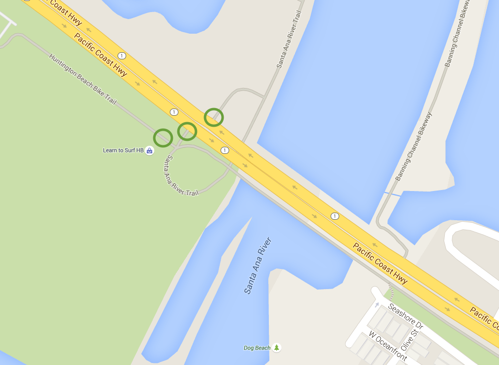
The length of the Santa Ana River Trail in Costa Mesa (highlighted in blue). Image and map data from Google 2015; click for a larger version.
I live in Costa Mesa and love riding on the Santa Ana River Trail (SART), a multiuse paved trail open to walkers, runners, bicyclists, skaters, and more (pretty much anything non-motorized). If you’ve never ridden it before, you’ve got to: the Santa Ana River Trail runs more than 30 miles inland from the Pacific Coast Highway (PCH) in Huntington Beach, where it connects up seamlessly with the beach’s bicycle path. And for that length it’s 100% car and crossing free – you have dozens of miles of paved trail to roll on continuously without stopping. Insanely useful for getting places in central Orange County while avoiding cars.
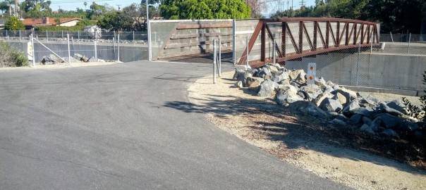
But getting on the trail isn’t always intuitive, especially as the trail crosses from one side of the river to the other within Costa Mesa’s borders. Starting near the ocean and heading inland, here are all the entrances from Costa Mesa:
The Santa Ana River Trail between Victoria/Hamilton and the beach is beautiful at high tide.
Lately I’ve started bicycling longer distances1, and as I’m riding, I’m seeing more of my local area. So many of the bicycle paths lead to stunning views, not to mention the gorgeous little parks.
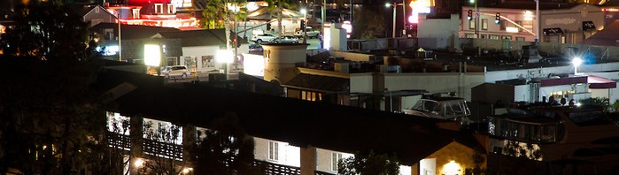
But now that it’s winter I’m out riding a lot at night. Night changes so much about the landscape, especially in urban areas where a single bright point-source of light (the sun or moon) is replaced by multiple small light sources, many of which are different colors and intensities. Combine the change in illumination with a requirement for long exposure times and you have a recipe for a dramatic visual change.
I wanted to try to capture some of that changed beauty, so I recently biked to a couple of my favorite vantage points in Newport Beach to try my hand at it.
A moonlit view of Newport Beach’s Lower Newport Bay (and partially Upper Newport Bay) with PCH (Pacific Coast Highway) to the right and Newport Center's many tall buildings that surround Fashion Island to the left. Saddleback Mountain can be seen off in the distance, to the left.West Newport Beach as seen from Ensign View Park (in Newport Heights). Visible to the left is the Lido Peninsula and western tip of Lido Island with the Via Lido Bridge; Pacific Coast Highway (PCH) is visible in the foreground, as are many of the buildings on the Newport Peninsula's / Balboa Peninsula's western portions. 2
But those are just general overviews; the image I’m happiest with takes just a piece of one of those and lets your eye linger on the details:
A closer look at a portion of west Newport Beach's Newport Harbor as seen at night from Ensign View Park. Pacific Coast Highway (PCH) is in the foreground; behind that are buildings on Newport Peninsula / Balboa Peninsula that front Newport Harbor, most striking among them is the multi-story Blackman Ltd. building at 3388 Via Lido Drive, with the parking structure at the Lido Marina Village on the right. Behind those and the palm trees lie two open-ocean oil platforms (one above the Blackman building, and one above the parking structure).
All of these are single-frame exposures with minimal manipulation in post processing. A few more images can be found in my Newport Beach at Night album.
1 I’m trying to get in at least 80 miles a week, and am hoping to build up to riding a century in a few months. 2 The two tall buildings on the left are the Vista Del Lido complex and the 601 Lido Condominiums; the two tall buildings on the right (that almost appear as one) are Newport: The Towers (3121 PCH) and Newport Surgery Center (3333 PCH).
I’ve been trying to do more of my errands by bicycling, and one of my biggest holdups has been a lack of cargo room: it’s hard to lug home 80 pounds of cat litter in a backpack. So, a few months ago I started shopping on Craigslist for a bike trailer, only to find out that a good friend had one in her garage that I could have for free.
My Schwinn Spirit bike trailer before modification.
That’s a Schwinn (Pacific Cycle) Spirit Bicycle Trailer, rated to hold up to two 50-lb kids (aka: 100 pounds of cargo!). I immediately fell in love with it, and even used it to lug home 80 pounds of cat litter from the pet store:
Two 42-pound bags of Fresh Step cat litter strapped in like kids into my bike trailer's child harness. So cute!
An unexpected bonus of the trailer is that whenever I have it attached to my bike, cars give me more maneuvering room. I bike on city streets in Orange County, CA, and am used to having only a few inches of space between my side mirror and the cars zipping past me. But when I’m using the trailer, most cars will actually change lanes before even attempting to pass me (or at least give me four or five feet of clearance), and I’ve had multiple people literally stop to let me go in front of them. Amazing.
But using the trailer for cargo has proved to be less than ideal, as the bottom of the trailer is just made of soft fabric: the kids’ weight is designed to be supported entirely by the harness (which is hung from a horizontal metal rod). So, unless I had cargo that was perfectly sized to fit into that harness (like the bags of cat litter), I was limited to low weight.
The bottom of the Schwinn Spirit bike trailer (with the child harness removed) is just thin fabric: not good for cargo.
So, I wanted to modify the trailer to add a solid base to convert it to a cargo trailer, and while I found lotsofDIY tutorials, they all involved removing the fabric. However, I wanted to keep the fabric on my trailer to protect my cargo from weather and prevent it from blowing around. Additionally, my guess is that the extra space I’m getting when I use the trailer is due to both the visual bulk of the trailer (it’s actually the same width as my handlebars, but makes my bike look much wider) and also because people think there are cute wittle children in the trailer and thus are panicked about the possibility of hitting them1.
So, what I ended up doing is removing the harness and adding a wooden shelf that fit inside the existing fabric, so my trailer now looks like this:
My finished cargo trailer!
Read on for full instructions on how I built this!
This afternoon I went for an end-of-the-year sunset bicycle ride along the Santa Ana River Trail and Huntington State Beach. I was mildly hoping for a last gorgeous sunset over the water, but dense fog rolled in well before sunset. The fog made it even more fun, though, as what few people there were largely headed home, leaving the beach to myself and a few other dedicated folks to enjoy a solitary and atmospheric end of the last day of the year.
A fire pit on the sand at Huntington State Beach on a foggy New Year's Eve.
Huntington Beach is lined with hundreds of giant concrete fire pits, which on summer evenings are often surrounded by people having beach parties. It was a cold day today (in the mid 60’s!), so there were only a brave few out to enjoy New Year’s Eve with a beach fire:
Room to spare.
While black and white suits the feel of the evening well, the fire made me have to process at least one in color; the warmth of the fire just draws your eye in (as it drew me in while I was there – it looked so wonderfully warm):
An empty fire pit on the sand at Huntington State Beach with a lone group of people having a New Year's Eve fire in the background.
Before I headed home on a beautiful foggy dusk bike ride, I couldn’t help but take a picture of this amazing nesting set of fire pits:
Matryoshka beach fire pits.
And, to show how foggy it was, here’s a picture of the Pacific Coast Highway bridge that crosses the Santa Ana “River” at the southern end of the beach:
Bridge over foggy waters.
Happy New Year!
Getting There
Huntington State Beach: The beach is a state park, and runs for miles along the coast of southern Huntington Beach. It is accessible from multiple points along Pacific Coast Highway (Highway 1) anywhere between Beach Blvd. to the north and Brookhurst St. to the south. There’s plenty of parking for cars right on the beach (unless you’re going on July 4th or at another peak time), though parking requires paying an entry fee to the park. I love visiting the beach in the winter, as the giant beach is largely empty, leading to a great feeling of solitude (especially when it’s foggy!). There’s a paved trail that runs the length of the beach, which is frequently used for bicycling, jogging, or roller blading.
Newport Back Bay is a relatively unknown1 jewel of coastal Orange County. At only a few miles long and half a mile wide at most, this estuary is relatively small. It’s also packed in between Newport Beach mansions houses, some of which overlook the wetlands from bluffs that line it. However, there is no major development inside the majority of the back bay, which is home to plants, birds, kayakers, and lots of other wildlife.
Looking towards the eastern bluffs from a roadside stop on Back Bay Drive in Newport Back Bay.
I’ve loved going to Newport Back Bay for years. It’s a great place to bike or jog, as there’s a paved trail looping around it2, and it’s a good place to go for bird watching (though I think Bolsa Chica is generally preferred by bird photographers). What’s neat about this area is that one moment you’re driving through fully developed Newport Beach and Irvine (Fashion Island Shopping Center and UC Irvine are only minutes away), and then the next you’re walking, biking, or driving along a one-lane road that meanders along the side of a beautiful coastal wetlands.
A few nights ago I went there to watch the sunset and experiment with some post-sunset techniques. The sunset was gorgeous: